-
You are here:
- Homepage »
- Azerbaijan »
- Baki » Puta

Puta Destination Guide
Explore Puta in Azerbaijan
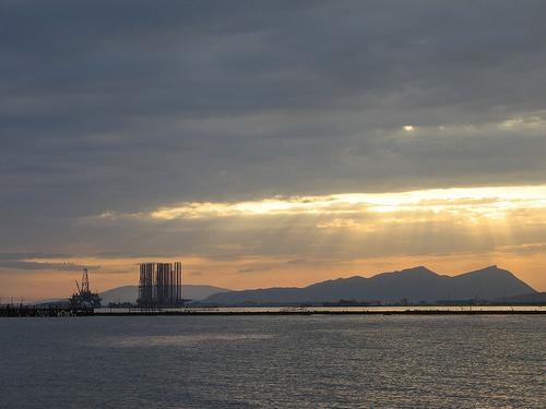
Puta in the region of Baki with its 1,018 inhabitants is a town in Azerbaijan - some 13 mi or ( 22 km ) South-West of Baku , the country's capital city .
Current time in Puta is now 10:53 AM (Sunday) . The local timezone is named " Asia/Baku " with a UTC offset of 4 hours. Depending on the availability of means of transportation, these more prominent locations might be interesting for you: Tabriz, Sari, Neftcala, Makhachkala, and Khasavyurt. Since you are here already, make sure to check out Tabriz . We saw some video on the web . Scroll down to see the most favourite one or select the video collection in the navigation. Where to go and what to see in Puta ? We have collected some references on our attractions page.
Videos
Azerbaijan land of magic colors
Azerbaijan ..
Haci Ahliman.
www.ahliman.com ..
Black&White photography by Shahin Huseynov. Music by Rafik Babaev
..
Novruz2011 bulvar.3gp
novruz ..
Videos provided by Youtube are under the copyright of their owners.
Interesting facts about this location
Şonqar
Şonqar (also, Shongar and Zagyar) is a settlement in Baku, Azerbaijan. The settlement forms part of the municipality of Qızıldaş in Qaradağ raion.
Located at 40.32 49.60 (Lat./Long.); Less than 6 km away
Azerbaijan Tower
Azerbaijan Tower is a proposed supertall skyscraper to be constructed on the Khazar Islands, 25 km (16 mi) south of Baku, Azerbaijan.
Located at 40.24 49.63 (Lat./Long.); Less than 7 km away
Khazar Islands
The Khazar Islands, also known as Caspian Islands, are artificial islands 25 km (16 mi) south of Baku, Azerbaijan consisting of 41 islands extending 3,000 hectares (about 11.6 sq mi) over the Caspian Sea.
Located at 40.24 49.63 (Lat./Long.); Less than 7 km away
Əhmədli (Baku Metro)
Əhmədli is a Baku Metro station. It was opened on April 28, 1989.
Located at 40.23 49.57 (Lat./Long.); Less than 11 km away
Heybət
Heybət (also, Eibat) is a settlement in Baku, Azerbaijan. The settlement forms part of the municipality of Lökbatan in Qaradağ raion.
Located at 40.34 49.78 (Lat./Long.); Less than 11 km away
Pictures
Historical Weather
Related Locations
Information of geographic nature is based on public data provided by geonames.org, CIA world facts book, Unesco, DBpedia and wikipedia. Weather is based on NOAA GFS.