
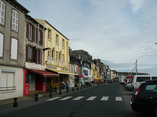
Touring Camaret-sur-Mer in France
Camaret-sur-Mer in the region of Bretagne with its 2,612 citizens is located in France - some 320 mi or ( 515 km ) West of Paris , the country's capital city .
Time in Camaret-sur-Mer is now 12:47 PM (Tuesday) . The local timezone is named " Europe/Paris " with a UTC offset of 1 hours. Depending on your budget, these more prominent places might be interesting for you: Oxford, Bristol, Cork, Rennes, and Quimper. Being here already, consider visiting Oxford . We collected some hobby film on the internet . Scroll down to see the most favourite one or select the video collection in the navigation. Check out our recommendations for Camaret-sur-Mer ? We have collected some references on our attractions page.
Videos
CAMARET PLAGE ET PORT, , Finistère, Bretagne
CAMARET Retrouvez toutes les photos sur www.flickr.com regardsurlefinistere.over-blog.fr ..
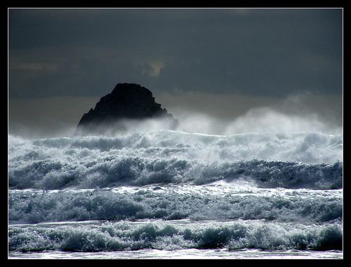
Große Wellen am Atlantik Bretagne Finistère, Windsurf, Tempete
nach einer stürmischen Nacht im September 2011 after a stormy night ... ..
Bretagna/Finistere
Viaggio in bicicletta in Bretagna ..
Storm and Waves Pen Hir - Pen Hat Bretagne Finistère
..
Videos provided by Youtube are under the copyright of their owners.
Interesting facts about this location
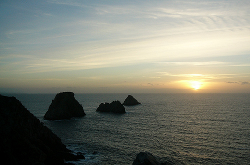
Camaret Bay
Camaret Bay is a small bay on the north coast of Brittany, France. In 1694 it was the site of the battle of Camaret, a naval action between French and English forces, which culminated in a disastrous amphibious landing by the English as part of an attempt to seize the nearby port of Brest.
Located at 48.29 -4.58 (Lat./Long.); Less than 2 km away
Kerviniou Batteries
The batteries de Kerviniou are artillery batteries built in the late 19th and early 20th centuries, and are made up of an upper battery (1891) and an underground magazine (1891) Located on the Roscanvel peninsula facing the Fort du Mengant, they are a late addition to the defences of the goulet de Brest (a lower battery near the site, dating to 1695, has not yet been found). Demilitarised in 1915, they are open to the public.
Located at 48.32 -4.58 (Lat./Long.); Less than 6 km away
Pointe de Cornouaille
La pointe de Cornouaille is a cape to the north of the hamlet of Kerviniou in France. They are both situated on the Roscanvel peninsula and, facing as it does the Fort du Mengant, a battery on the point forms part of the defences of the goulet de Brest.
Located at 48.33 -4.57 (Lat./Long.); Less than 6 km away
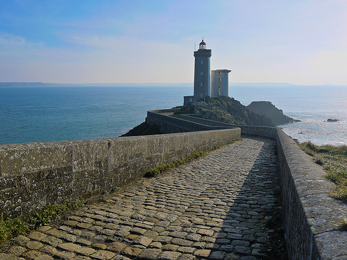
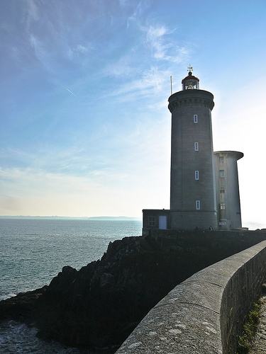
Phare du Petit Minou
The Phare du Petit Minou is a lighthouse in the roadstead of Brest, standing in front of the Fort du Petit Minou, in the commune of Plouzané. By aligning it with the phare du Portzic, it shows the safe route to follow for ships to enter the roadstead.
Located at 48.34 -4.61 (Lat./Long.); Less than 7 km away
Fort du Petit Minou
Built between 1694 and 1697, the Fort du Petit Minou was a fort built in the commune of Plouzané in France to defend the goulet de Brest. It consists of 6m high masonry bastions, surrounded by a 3m deep and 9.5m wide moat. Vauban completed the defences along the goulet and at this fort installed 240 cannons and a command post for directing fire and coordinating the defences' magazines. It was reinforced in the 18th and 19th centuries, with the phare du Petit Minou being added nearby in 1848.
Located at 48.34 -4.61 (Lat./Long.); Less than 7 km away
Pictures


Related Locations
Information of geographic nature is based on public data provided by geonames.org, CIA world facts book, Unesco, DBpedia and wikipedia. Weather is based on NOAA GFS.