-
You are here:
- Homepage »
- France »
- Languedoc-Roussillon » Elna

Elna Destination Guide
Discover Elna in France
Elna in the region of Languedoc-Roussillon with its 7,007 habitants is a town located in France - some 433 mi or ( 697 km ) South of Paris , the country's capital .
Local time in Elna is now 02:45 AM (Monday) . The local timezone is named " Europe/Paris " with a UTC offset of 1 hours. Depending on your flexibility, these larger cities might be interesting for you: Saint-Esteve, Saint-Cyprien, Perpignan, Palau-del-Vidre, and Montpellier. When in this area, you might want to check out Saint-Esteve . We found some clip posted online . Scroll down to see the most favourite one or select the video collection in the navigation. Are you looking for some initial hints on what might be interesting in Elna ? We have collected some references on our attractions page.
Videos
Aqualand St Cyprien
Attraction ..
Elne in 4 minutes
A quick jog round the cobbled streets of "Upper" Elne in France ..
Eurocamp.de: Camping Le Dauphin, Argelès sur mer - Südfrankreich, Rousillon - Familienurlaub
Le Dauphin - Dies ist ein Platz, der seit seinem Einstand 1991 von unseren Gästen stets sehr gut bewertet wurde! Unweit der Küste, inmitten von Obstgärten, liegt dieser relativ kleine Platz, der doch ..
Ca bouge a St Cyp
ballade sur les hauteurs de St Cyprien. Aout 2005 ..
Videos provided by Youtube are under the copyright of their owners.
Interesting facts about this location
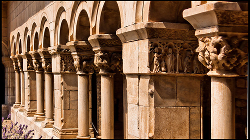
Elne Cathedral
Elne Cathedral (French: Cathédrale Sainte-Eulalie-et-Sainte-Julie d'Elne, Catalan: Catedral de Santa Eulàlia d'Elna) is a former Roman Catholic cathedral, and a national monument of France, located in the town of Elne in the County of Roussillon. It was the seat of the former Bishopric of Elne, which was transferred to the Bishopric and cathedral of Perpignan in 1601. The cathedral was consecrated in 1069.
Located at 42.60 2.97 (Lat./Long.); Less than 0 km away
Tech (river)
The Tech is a river in southern France, very close to the French-Spanish border. It runs through a valley in the Pyrénées-Orientales, in the former Roussillon, and is 84 km long. Its source is the Parcigoule Valley (2,500 metres high) and it feeds the Mediterranean Sea. At Céret, the medieval Devil's bridge, once the largest bridge arch in the world, spans the river in an arc of 45 m length.
Located at 42.59 3.05 (Lat./Long.); Less than 6 km away
Lac de Villeneuve-de-la-Raho
Lac de Villeneuve-de-la-Raho is a lake in Pyrénées-Orientales, France.
Located at 42.63 2.90 (Lat./Long.); Less than 7 km away
Camp de concentration d'Argelès-sur-Mer
The Camp de concentration d'Argelès-sur-Mer was a concentration camp established in February 1939 on the territory of the French commune of Argelès-sur-Mer for members of the retirada. The retirada was the retreat of the remains of the Spanish Republican Army (Ejército Popular Republicano) after their defeat in the Spanish Civil War. The commune and the camp were on the Mediterranean coast at the east end of the Pyrenees, 25 km north of Cap de Creus.
Located at 42.58 3.05 (Lat./Long.); Less than 7 km away
Route Départementale 914
The Route Départementale 914 or RD 914 is the scenic route by the Mediterranean sea, between Perpignan and Cerbere, at the Spanish border. Formerly named Route Nationale 114, or RN 114 before being handeld to the département of Pyrénées-Orientales, on December 5 2005. It becomes the Spanish National Road N-260 or Eix Pirenenc as it crosses the border toward Portbou. The N-260 is about to be upgraded into a Highway, the "Autovía del Eje Pirenaico" or "Autovia del Eix Pirenenc", the Autovía A-26.
Located at 42.55 3.03 (Lat./Long.); Less than 7 km away
Pictures
Historical Weather
Related Locations
Information of geographic nature is based on public data provided by geonames.org, CIA world facts book, Unesco, DBpedia and wikipedia. Weather is based on NOAA GFS.