-
You are here:
- Homepage »
- France »
- Languedoc-Roussillon » Olargues

Olargues Destination Guide
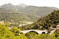
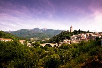
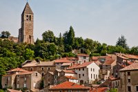
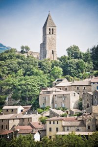
Delve into Olargues in France
Olargues in the region of Languedoc-Roussillon with its 644 residents is a city in France - some 367 mi or ( 591 km ) South of Paris , the country's capital .
Current time in Olargues is now 06:54 PM (Wednesday) . The local timezone is named " Europe/Paris " with a UTC offset of 1 hours. Depending on your travel modalities, these larger destinations might be interesting for you: Saint-Gervais-sur-Mare, Saint-Genies-de-Varensal, Saint-Chinian, Rosis, and Rodez. While being here, make sure to check out Saint-Gervais-sur-Mare . We encountered some video on the web . Scroll down to see the most favourite one or select the video collection in the navigation. Are you curious about the possible sightseeing spots and facts in Olargues ? We have collected some references on our attractions page.
Videos
Canal du Midi
Our penichette voyage in the south of France, fall 2008. ..
Bardou Streetview
Bardou Streetview Mit diesem Video ist es möglich vom PC aus virtuell durch Bardou zu laufen. Ihr könnt selber bestimmen welchen Weg ihr laufen wollt! Bardou liegt in Süd-Frankreich bei Mons La Trival ..
le Poujol sur Orb
..
Property For Sale in the France: near to mons la trivalle La
French Property For Sale in Languedoc-Roussillon, Hrault 34, France - FULL DESCRIPTION BELOW This property can be found at www.frenchpropertyshop.com This French property has the following features + ..
Videos provided by Youtube are under the copyright of their owners.
Interesting facts about this location
Dourdou de Camarès
The Dourdou de Camarès is an 86.9 km long river in the Tarn, Hérault and Aveyron départements, southern France. Its source is in the Parc naturel régional du Haut-Languedoc, in the commune of Murat-sur-Vèbre, 5.5 km southeast of the village. It flows generally northwest. It is a left tributary of the Tarn into which it flows at Broquiès, 1.2 km southwest of the village. Its main tributary is the Sorgues.
Located at 43.66 2.91 (Lat./Long.); Less than 11 km away
Saint-Pons-de-Thomières Cathedral
Saint-Pons-de-Thomières Cathedral (Cathédrale Saint-Pons de Saint-Pons-de-Thomières) is a former Roman Catholic cathedral, and national monument of France, in Saint-Pons-de-Thomières. It was formerly the seat of the Bishopric of Saint-Pons, founded like a number of bishoprics in the region in the aftermath of the suppression of the Albigensians.
Located at 43.49 2.76 (Lat./Long.); Less than 15 km away
Lac du Laouzas
Lac du Laouzas is a lake in Tarn, France. At an elevation of 790 m, its surface area is 3.35 km².
Located at 43.65 2.78 (Lat./Long.); Less than 15 km away
Bakio
Baquio (in Basque and officially Bakio) is a municipality in the province of Biscay.
Located at 43.42 2.81 (Lat./Long.); Less than 17 km away
Mare (river)
The Mare River is a river in the Hérault département of Southern France, which rises in the Caroux-Espinouse hills. The river's source is above Castanet-le-Haut in the Parc naturel régional du Haut-Languedoc. The river passes through Saint-Gervais-sur-Mare and Villemagne-l'Argentière, before joining the Orb River at Hérépian.
Located at 43.59 3.12 (Lat./Long.); Less than 17 km away
Pictures
Historical Weather
Related Locations
Information of geographic nature is based on public data provided by geonames.org, CIA world facts book, Unesco, DBpedia and wikipedia. Weather is based on NOAA GFS.

