-
You are here:
- Homepage »
- France »
- Provence-Alpes-Cote d'Azur » Les Baumettes

Les Baumettes Destination Guide
Touring Les Baumettes in France
Les Baumettes in the region of Provence-Alpes-Côte d'Azur is located in France - some 416 mi or ( 669 km ) South of Paris , the country's capital city .
Time in Les Baumettes is now 09:56 PM (Thursday) . The local timezone is named " Europe/Paris " with a UTC offset of 1 hours. Depending on your budget, these more prominent places might be interesting for you: Vert Plan, Toulon, Sormiou, Plan-de-Cuques, and Nîmes. Being here already, consider visiting Vert Plan . We collected some hobby film on the internet . Scroll down to see the most favourite one or select the video collection in the navigation. Check out our recommendations for Les Baumettes ? We have collected some references on our attractions page.
Videos
ADN KHATTABI - Ohoh! ft. ZBATATA
Découvrez le clip de ADN KHATTABI "Ohoh!" en featuring avec ZBATATA. Extrait de la GUERILLA MIXTAPE. www.facebook.com www.facebook.com www.facebook.com Mix & mastering : Big M Prod : Rakam Beat Réalis ..
Le Corbusier's Unité d'Habitation
Le Corbusier's Unité d'Habitation in Marseille. Visit to the Unite d'Habitation in Marseille built 1947-1952, visited July 2008. The building is conceived as a city in the sky, a 12 storey multi-use h ..
marseille eastern skate sessions 2009
a short film of this years marseille trip. featuring guillaume mocquin, thilo nawrocki, robin mentrup, fabian wenzel, christopher flemming, julius dittmann and many more. we had hell of a time. thanks ..
We Built This City - Guitar
Chouette titre de starship La guitare est une Ibanez Artist AR300 de 1981 ..
Videos provided by Youtube are under the copyright of their owners.
Interesting facts about this location
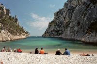
Massif des Calanques
The Massif des Calanques is a wild and rugged terrain stretching from the ninth arondissement of Marseille to the east towards Cassis, spanning 20 km in length and 4 km in width along the coast. Its highest peak is Mont Puget at 565m. This is one of France's great natural beauty areas.
Located at 43.22 5.43 (Lat./Long.); Less than 2 km away
Calanque
A calanque (from the Corsican and Occitan words of pre-Indo-European origin calanca with meaning "inlet") is a steep-walled inlet, cove, or bay that is developed in limestone, dolomite, or other carbonate strata and found along the Mediterranean coast. A calanque is a steep-sided valley formed within karstic regions either by fluvial erosion or the collapse of the roof of a cave that has been subsequently partially submerged by a rise in sea level.
Located at 43.21 5.42 (Lat./Long.); Less than 2 km away
Calanque de Sormiou
The Calanque de Sormiou is one of the big Calanques between Marseille and La Ciotat. It is famous for its climbing spots. Access by car is restricted due to the risk of forest fires.
Located at 43.21 5.43 (Lat./Long.); Less than 2 km away
Calanque de Morgiou
The Calanque de Morgiou is one of the biggest calanques located between Marseille and Cassis. Formerly a fishing port, it is famous for the gigantic tuna fishing organized there in 1622, when the king Louis XIII paid a visit to Marseille. It still houses small fishing cabins, but they're now used for tourism rather than fishing. The Calanque de Morgiou is also famous for the Cosquer cave, an underwater grotto containing numerous cave drawings dating back as far as 27,000 years BP.
Located at 43.21 5.45 (Lat./Long.); Less than 3 km away
Calanque de Sugiton
The Calanque de Sugiton is one of the numerous calanques located between Marseille and Cassis. While quite small, Sugiton is perhaps the most known of all Marseille calanques, simply because it can be easily accessed by hikers, and because it is open to tourists even during hot season, unlike most calanques. A small beach can be found at the extremity of the calanque.
Located at 43.21 5.46 (Lat./Long.); Less than 4 km away
Pictures
Historical Weather
Related Locations
Information of geographic nature is based on public data provided by geonames.org, CIA world facts book, Unesco, DBpedia and wikipedia. Weather is based on NOAA GFS.


