-
You are here:
- Homepage »
- Greece »
- North Aegean » Iraion

Iraion Destination Guide
Touring Iraion in Greece
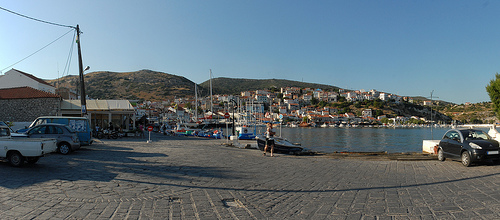
Iraion in the region of North Aegean with its 210 citizens is a city located in Greece - some 174 mi or ( 280 km ) East of Athens , the country's capital city .
Time in Iraion is now 04:45 AM (Friday) . The local timezone is named " Europe/Athens " with a UTC offset of 2 hours. Depending on your travel resources, these more prominent places might be interesting for you: Vourliotai, Vathy, Samos, Kos, and Kokkarion. Being here already, consider visiting Vourliotai . We collected some hobby film on the internet . Scroll down to see the most favourite one or select the video collection in the navigation. Check out our recommendations for Iraion ? We have collected some references on our attractions page.
Videos
airberlin - Airbus A320-214 - D-ALTD - Landung in Samos
Landung in Samos (SMI/LGSM) aus Düsseldorf (DUS/EDDL) kommend am 16. Juni 2008 um 11:01 Uhr auf der Landebahn 09. *Cockpit-Sicht* ..
Papas Beach GR-Samos-Ireon
Herrlicher Strand mit Verpflegung nahe Ireon ..
Samos Summer Holiday
A gathering of several people in the fish tavern of Captain Miltos in Ireon on Samos yielded this spontaneous version of the song: "We're all going on a Samos Holiday"! Samos island, Greece, June 9th ..
Pagondas. Samos. Greece. June 2010.3gp
A visit at Nicos' Taverna in Pagondas, Samos, and a small walk in the town. 16. of June 2010. ..
Videos provided by Youtube are under the copyright of their owners.
Interesting facts about this location
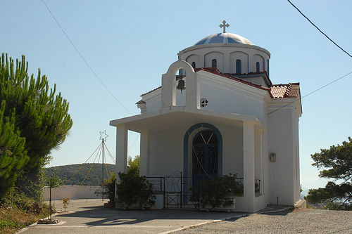
Heraion of Samos
The Heraion of Samos was a large sanctuary to the goddess Hera, in the southern region of Samos, Greece, 6 km southwest of the ancient city, in a low, marshy river basin near the sea. The Late Archaic Heraion of Samos was the first of the gigantic free-standing Ionic temples, but its predecessors at this site reached back to the Geometric Period of the 8th century BC, or earlier.
Located at 37.67 26.89 (Lat./Long.); Less than 1 km away
Samos International Airport
Samos International Airport (also known as Aristarchos) is an airport on Samos Island, Greece. The airport is named after Aristarchos of Samos, an ancient astronomer and mathematician, and lies within 5 km from the nearby town of Pythagorio. The airport features a single runway serving both arrivals and departures. During the late 1990s/early 2000s, the terminal was renovated to increase size and keep it modern. The old terminal remains there unused at the side.
Located at 37.69 26.91 (Lat./Long.); Less than 4 km away
Pythagoreion
The Pythagoreion is an ancient fortified port in Samos, Greece. A nice and tranquil city with charter- and yacht tourism as its main industry today. It has three ports with a new marina and a dock for ferrys and passangerboats to other islands like Pathmos and to mainland Greece and Turkey. I contains ancient Greek and Roman monuments and a famous ancient tunnel, the Tunnel of Eupalinos or Eupalinian aqueduct.
Located at 37.70 26.87 (Lat./Long.); Less than 4 km away
Tunnel of Eupalinos
The Tunnel of Eupalinos or Eupalinian aqueduct (Modern Greek: Efpalinio orygma, Ευπαλίνειο όρυγμα) is a tunnel of 1,036 m length in Samos, Greece, built in the 6th century BC to serve as an aqueduct. The tunnel is the second known tunnel in history which was excavated from both ends, and the first with a geometry-based approach in doing so. Today it is a popular tourist attraction.
Located at 37.69 26.93 (Lat./Long.); Less than 5 km away
Samos Prefecture
Samos Prefecture was a prefecture in Greece, consisting of the islands of Samos, Ikaria and the smaller islands of Fournoi Korseon. In 2011 the prefecture was abolished and the territory is now covered by the regional units of Samos and Ikaria. Its capital was the town of Vathy, on Samos.
Located at 37.73 26.83 (Lat./Long.); Less than 9 km away
Pictures


Historical Weather
Related Locations

Information of geographic nature is based on public data provided by geonames.org, CIA world facts book, Unesco, DBpedia and wikipedia. Weather is based on NOAA GFS.