-
You are here:
- Homepage »
- Greece »
- Peloponnese » Kiveri

Kiveri Destination Guide
Explore Kiveri in Greece
Kiveri in the region of Peloponnese with its 979 inhabitants is a town in Greece - some 62 mi or ( 100 km ) South-West of Athens , the country's capital city .
Current time in Kiveri is now 05:41 AM (Sunday) . The local timezone is named " Europe/Athens " with a UTC offset of 2 hours. Depending on the availability of means of transportation, these more prominent locations might be interesting for you: Tolo, Timenion, Lacedaemon, Patras, and Paralion Astros. Since you are here already, make sure to check out Tolo . We saw some video on the web . Scroll down to see the most favourite one or select the video collection in the navigation. Where to go and what to see in Kiveri ? We have collected some references on our attractions page.
Videos
The Streets of Nafplion Greece
Nafplio is a perfect city to stroll and relax on vacation. Nafplion is a port, with fishing and transport ongoing, although the primary source of local employment currently is tourism, with two beache ..
Palamidi Castle in Nafplio Greece
This fortress overlooks Nafplio and the Aegean Sea. It is so quiet and beautiful up here. ..
ARGOLIDA - VOICES FROM THE PAST ( NAFPLIO ARGOS KEFALARI )
ARGOLIDA HAS GREAT HISTORY.WHEN YOU'RE THERE,YOU CAN FEEL THE ENERGY OF THE PAST... HERE YOU'LL SEE THE CASTLE "PALAMIDI" AT THE EX CAPITAL OF GREECE(NAFPLIO),THE CASTLE OF ARGOS AND THE CAVE OF KEFAL ..
Dancing the night away in Nafplio Greece
We were lucky enough to be in Nafplio Greece during Carnival. We had a great time at the party celebrated in the streets of Nafplio. ..
Videos provided by Youtube are under the copyright of their owners.
Interesting facts about this location
Kiveri
Kiveri is a small village in the municipal unit of Lerna, Argolis, Greece. It is situated on the bay of Argos across from the tourist center of Nafplio. It has a population of approximately 2,500. According to legend it was founded in 1600 BC by some of the first Dorian invaders of the Peloponnese. Scholarly research finds that the village has been continuously occupied since antiquity.
Located at 37.52 22.73 (Lat./Long.); Less than 1 km away
Lerna
In classical Greece, Lerna was a region of springs and a former lake near the east coast of the Peloponnesus, south of Argos. Its site near the village Mili at the Argolic Gulf is most famous as the lair of the Lernaean Hydra, the chthonic many-headed water snake, a creature of great antiquity when Heracles killed it, as the second of his labors. The strong Karstic springs remained; the lake, diminished to a silt lagoon by the 19th century, has vanished.
Located at 37.55 22.72 (Lat./Long.); Less than 3 km away
Inachos (river)
The Inachos is a river in the Peloponnese, southern Greece. Its source is in the mountains of western Argolis, near the village Kaparelli. It flows into the Aegean Sea in Nea Kios. The Inachos was named after Inachus, a mythical king of Argos, who introduced civilization to the area.
Located at 37.59 22.75 (Lat./Long.); Less than 7 km away
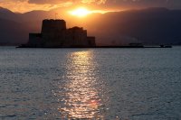
Bourtzi (Nafplio)
The castle of Bourtzi (Greek: Μπούρτζι, from Ottoman Turkish برج - burc meaning "tower") is located in the middle of the harbour of Nafplio. The Venetians completed its fortification in 1473 to protect the city from pirates and invaders from the sea. The Greeks regained it from the Turks on June 18, 1822, from where they assisted in the siege of Nafplio. Until 1865 it served as a fortress. It was then transformed into residence of the executioners of convicts from the castle of Palamidi.
Located at 37.57 22.79 (Lat./Long.); Less than 7 km away
Palamidi
Palamidi is a fortress to the east of the Acronauplia in the town of Nafplio in the Peloponnese region of southern Greece. Nestled on the crest of a 216-metre high hill, the fortress was built by the Venetians during their second occupation of the area (1686–1715). The fortress was a very large and ambitious project, but was finished within a relatively short period from 1711 until 1714. It is a typical baroque fortress based on the plans of the engineers Giaxich and Lasalle.
Located at 37.56 22.80 (Lat./Long.); Less than 8 km away
Pictures
Historical Weather
Related Locations
Information of geographic nature is based on public data provided by geonames.org, CIA world facts book, Unesco, DBpedia and wikipedia. Weather is based on NOAA GFS.

