-
You are here:
- Homepage »
- Greece »
- South Aegean » Megisti

Megisti Destination Guide
Discover Megisti in Greece
Megisti in the region of South Aegean is a town located in Greece - some 348 mi or ( 560 km ) East of Athens , the country's capital .
Local time in Megisti is now 10:30 PM (Friday) . The local timezone is named " Europe/Athens " with a UTC offset of 2 hours. Depending on your flexibility, these larger cities might be interesting for you: Nicosia, Demre, Saribelen, Mugla, and Bogazcik. When in this area, you might want to check out Nicosia . We found some clip posted online . Scroll down to see the most favourite one or select the video collection in the navigation. Are you looking for some initial hints on what might be interesting in Megisti ? We have collected some references on our attractions page.
Videos
KASTELORIZO The Blue Cave
This little known underwater cave is one of the largest in the Mediterranean Sea, often visited by sea lions native to these waters. Kastelorizo being one of the smallest Greek islands is known more t ..
Kastellorizo landing
The setting of the airport at Kastellorizo is spectacular. Here it is in May 2011 ..
Kastelorizo Greece
Kastelorizo, Greece's most southeastern island. A fly over the island including its speactacular airfield and the main town the day a total eclipse of the sun took place at the area (29th March 2006) ..
KASTELORIZO - A Sailors Visit
Kastelorizo, one of the smallest inhabited Greek Islands is also one of the most popular stop overs for sailors for its pristine waters and traditional fish tavernas. The only village on the island is ..
Videos provided by Youtube are under the copyright of their owners.
Interesting facts about this location
Operation Abstention
Operation Abstention was the code name given to the British invasion of the Italian island of Kastelorizo, off Turkey, during the Second World War, on late February 1941. The goal was to establish a pivotal base to challenge the Italian naval and air supremacy on the Dodecanese islands.
Located at 36.15 29.59 (Lat./Long.); Less than 0 km away
Kastellorizo Airport
Kastellorizo Island Public Airport is an airport on the small island Kastellorizo, Greece, part of the Dodekanesos island group. The facility is located more or less on the middle of the Island, about 2.5 km southwest of the city Megisti. In the beginning of the twentieth century, the island of Kastellorizo was linked by seaplanes to destinations mainly in northeast Africa. The seaplanes used the natural horse-shoe sized harbour of the island.
Located at 36.14 29.58 (Lat./Long.); Less than 2 km away
Strongyli Kastellorizou
Strongyli Kastellorizou, also called Strongili or Ipsili, is a Greek islet which lies in the eastern Mediterranean Sea, about five nautical miles south-east of the island of Kastelorizo. The island is about 1.5 km long, and up to 700 m wide. It covers an area of about 0.9 km. It is rather flat and covered with macchia. The islet has no permanent residents. Strongyli is the easternmost Greek Territory. Administratively it is part of the Municipality of Megisti.
Located at 36.12 29.63 (Lat./Long.); Less than 5 km away
Uluburun shipwreck
The Uluburun Shipwreck is a Late Bronze Age shipwreck dated to the late 14th century BC, discovered close to the east shore of Uluburun (Grand Cape), and about 6 miles southeast of Kaş, in south-western Turkey. The shipwreck was first discovered in the summer of 1982 by Mehmed Çakir, a local sponge diver from Yalikavak, a village near Bodrum.
Located at 36.13 29.69 (Lat./Long.); Less than 9 km away
Ro, Greece
Ro or Rho is a small Greek island in the eastern Mediterranean Sea near Kastelorizo, close to the Turkish coast. It is part of the municipality of Megísti (Kastelorizo), in the South Aegean region. Together with other islets in the surrounding region, Ro was the object of a sovereignty dispute in the 1920s between Turkey and Italy, which at the time was in possession of Kastelorizo and the Dodecanese islands. The dispute was solved in a 1932 treaty, which assigned Ro to the Italian side.
Located at 36.16 29.50 (Lat./Long.); Less than 9 km away
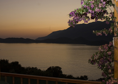
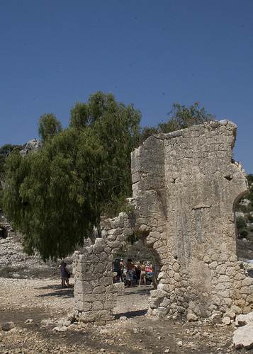
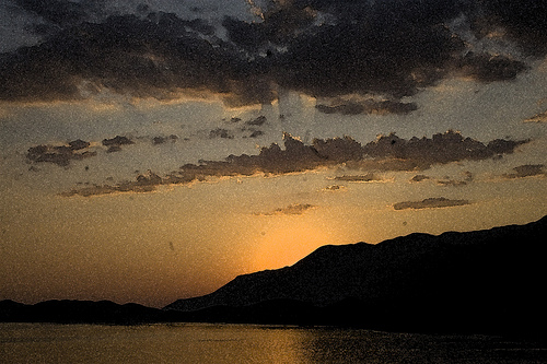
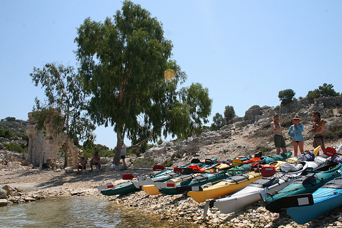
Pictures


Historical Weather
Related Locations
Information of geographic nature is based on public data provided by geonames.org, CIA world facts book, Unesco, DBpedia and wikipedia. Weather is based on NOAA GFS.