-
You are here:
- Homepage »
- India »
- Uttarakhand » Raiwala

Raiwala Destination Guide
Discover Raiwala in India
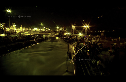
Raiwala in the region of Uttarakhand with its 5,198 habitants is a place located in India - some 113 mi or ( 181 km ) North-East of New Delhi , the country's capital .
Local time in Raiwala is now 11:06 AM (Sunday) . The local timezone is named " Asia/Kolkata " with a UTC offset of 5.5 hours. Depending on your mobility, these larger cities might be interesting for you: Lahore, Kasur, Shimla, Rishikesh, and New Delhi. When in this area, you might want to check out Lahore . We discovered some clip posted online . Scroll down to see the most favourite one or select the video collection in the navigation. Are you looking for some initial hints on what might be interesting in Raiwala ? We have collected some references on our attractions page.
Videos
VISIT TO HARIDWAR - THE HOLI CITY
Haridwar, a place that everyone wants to visit because it is not only a unique Holy city but because it offers you peace, tranquility and a glimpse of Indian ancient traditions. It is said that a bath ..
Haridwar and rishikesh Desh_karthik's photos around Haridwar, India (devprayag land slide)
Preview of Desh_karthik's blog at TravelPod. Read the full blog here: www.travelpod.com This blog preview was made by TravelPod using the TripAdvisor™ TripWow slideshow creator. Learn more about these ..
Haridwar city and the temples Kalyandasgupta's photos around Haridwar, India
Preview of Kalyandasgupta's blog at TravelPod. Read the full blog here: www.travelpod.com This blog preview was made by TravelPod using the TripAdvisor™ TripWow slideshow creator. Learn more about the ..
The yamunotri Desh_karthik's photos around Haridwar, India (experience of haridwar bath)
Preview of Desh_karthik's blog at TravelPod. Read the full blog here: www.travelpod.com This blog preview was made by TravelPod using the TripAdvisor™ TripWow slideshow creator. Learn more about these ..
Videos provided by Youtube are under the copyright of their owners.
Interesting facts about this location
Pratitnagar
Pratitnagar is a census town in Dehradun district in the Indian state of Uttarakhand.
Located at 30.03 78.22 (Lat./Long.); Less than 2 km away
Song river (Dehradun)
The Song is a river in Dehradun that drains the eastern part of the valley. It originates in the southern slopes of the Himalayan range running from Dhanolti toward Narendranagar. As is common in hilly areas, there are several streams running south from the mountains that merge into one river that emerges out of the hills a little after Shahastradhara.
Located at 30.03 78.25 (Lat./Long.); Less than 4 km away
Pashulok Barrage
The Pashulok Barrage is a barrage located on the Ganges River just south of Rishikesh in Dehradun district, Uttarakhand, India. In a run-of-the-river scheme, the main purpose of the barrage is to divert water into a canal on the east bank of the river which feeds water to the Chilla Power Plant downstream at {{#invoke:Coordinates|coord}}{{#coordinates:29|58|34|N|78|13|11|E| | |name=Chilla Power Plant }}, 4 km upstream of Haridwar.
Located at 29.98 78.22 (Lat./Long.); Less than 5 km away
Sapta Puri
Sapta Puri are seven holy pilgrimage centres in India where the word 'puri' means "town" or "city" suffixed to the word 'sapta' meaning "seven". Specifically, the names of the pilgrimage centres, which are tirthas (holy places), are: Ayodhya, Mathura, Haridwar, Varanasi (Benaras, Kashi), Kanchipuram, Ujjain (Avanti) and Dwarka (अयोध्या, मथुरा, हरिद्वर,वाराणसी, कांचीपूरम्,उजैनी,द्वारका). In Hinduism, tirtha connotes religious places of spiritual importance.
Located at 29.96 78.16 (Lat./Long.); Less than 8 km away
Veerbhadra
Veerbhadra is a town in Dehradun district in the Indian state of Uttarakhand, situated close to the pilgrimage town of Rishikesh. It is most known as the factory township of Indian Drugs and Pharmaceuticals Limited, Rishikesh plant (IDPL), a Government of India undertaking, established in 1967, with about 2700 houses, with Inter College and a Kendriya Vidyalaya, established in 2003 The town also has a Neem Karoli Baba Ashram and a Sri Hanuman Mandir.
Located at 30.07 78.28 (Lat./Long.); Less than 9 km away
Pictures
Historical Weather
Related Locations
Information of geographic nature is based on public data provided by geonames.org, CIA world facts book, Unesco, DBpedia and wikipedia. Weather is based on NOAA GFS.