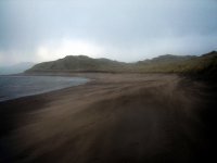
Explore Strandhill in Ireland
Strandhill in the region of Connaught is a town in Ireland - some 116 mi or ( 186 km ) North-West of Dublin , the country's capital city .
Current time in Strandhill is now 10:09 PM (Tuesday) . The local timezone is named " Europe/Dublin " with a UTC offset of 0 hours. Depending on the availability of means of transportation, these more prominent locations might be interesting for you: Derry, Enniskillen, Belfast, Tullamore, and Sligo. Since you are here already, make sure to check out Derry . We encountered some video on the web . Scroll down to see the most favourite one or select the video collection in the navigation. Where to go and what to see in Strandhill ? We have collected some references on our attractions page.
Videos
Maeve's Cairn, Co. Sligo, Ireland. Huge, spectacular burial mound.
standingwithstones.net Standing with Stones is a remarkable and unprecedented documentary film that takes the viewer beyond Stonehenge on an incredible journey of discovery that reveals the true wealt ..
Carrowmore Megalithic Cemetery - Ireland
A short video of the mysterious Carrowmore Megalithic Cemetery located near Sligo Ireland. There are more than 20 ancient tombs, including stone rings and portal tombs. A truely mystical area of Irela ..
Voya Seaweed Baths
VOYA Seaweed Baths, Strandhill, Sligo has used generations of aquired wisdom about the sea to bring you an truly unique Irish Spa experience. Take an organic approach to well being with VOYA a USDA an ..
motocross sligo alan age 7
my seven year old sun having fun out on his bike on a lovely sunny day march 2012 in lower rosses, sligo ireland ..
Videos provided by Youtube are under the copyright of their owners.
Interesting facts about this location
Sligo Airport
Sligo Airport is located in Strandhill, County Sligo, 5 NM west of Sligo in Ireland. The airport is a small regional airport and has no scheduled routes.
Located at 54.28 -8.60 (Lat./Long.); Less than 1 km away
Knocknarea
Knocknarea is a large hill west of Sligo town in County Sligo, Republic of Ireland. The 327-metre high limestone hill is visually striking, as it is monolithic in appearance and stands in a prominent position on the Cúil Irra peninsula between the bays of Sligo and Ballysadare. At the summit is a large mound of loose stones. Although it has not been excavated, it is believed to conceal a Neolithic passage tomb.
Located at 54.26 -8.57 (Lat./Long.); Less than 2 km away
County Sligo
County Sligo is a county in Ireland. It is located in the Border Region and is also part of the province of Connacht. It is named after the town of Sligo. Sligo County Council is the local authority for the county. The population of the county is 65,393 according to the 2011 census. An archaeological recovery suggests the county may have been one of the earliest places of human settlement in Ireland.
Located at 54.25 -8.67 (Lat./Long.); Less than 5 km away
Carrowmore
Carrowmore, County Sligo (Irish: An Cheathrú Mhór, meaning Great Quarter) is one of the four major passage tomb cemeteries in Ireland. It is located at the centre of a prehistoric ritual landscape on the Cúil Irra Peninsula in County Sligo in Ireland. Around 30 megalithic tombs can be seen in Carrowmore today. The tombs (in their original state) were almost universally 'dolmen circles'; small dolmens each enclosed by a boulder ring of 12 to 15 metres.
Located at 54.25 -8.52 (Lat./Long.); Less than 5 km away
Listoghil
Listoghil (Irish: Lios an tSeagail) is the large central monument in the Carrowmore group of prehistoric tombs in County Sligo in Ireland. It was numbered as Carrowmore 51 by George Petrie in 1837 and this designation is still used. According to Petrie (Letter to Larcom, Aug. 1837), the name may mean 'Ryefort' (it appears as Lios a tSeagail, seagail meaning rye in Irish, in early maps). Listoghil stands at the highest point in the Carrowmore complex, about 50m above sea level.
Located at 54.25 -8.52 (Lat./Long.); Less than 5 km away
Pictures
Related Locations
Information of geographic nature is based on public data provided by geonames.org, CIA world facts book, Unesco, DBpedia and wikipedia. Weather is based on NOAA GFS.


