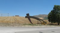
Delve into Santa Ninfa in Italy
Santa Ninfa in the region of Sicily with its 5,087 residents is a city in Italy - some 286 mi or ( 460 km ) South of Rome , the country's capital .
Current time in Santa Ninfa is now 05:52 PM (Saturday) . The local timezone is named " Europe/Rome " with a UTC offset of 1 hours. Depending on your travel modalities, these larger destinations might be interesting for you: Tunis, Bizerte, Kairouan, Vita, and Villabate. While being here, make sure to check out Tunis . We encountered some video on the web . Scroll down to see the most favourite one or select the video collection in the navigation. Are you curious about the possible sightseeing spots and facts in Santa Ninfa ? We have collected some references on our attractions page.
Videos
sicilia vacanze 2007
west sicily ..
Hose Pipe Water Fight
Sicilia 2011, Very Hot Day, All We Needed Was A Water Fight! ..
Salemi - Kakawa - Gara torte al minuto - Hotel Mokarta - 2012
Dalla manifestazione KAKAWA in programma all'Hotel Mokarta di Salemi il 21, 22 e 25 Aprile, un breve video della "Gara torte al minuto" ..
Commercial warehouse storage sicily
Commercial warehouse storage factory site in Sicily. Logistically positioned between Palermo and Mazara del Vallo 5 minutes from the motorway. On site residential accomodation 150 sqm and offices 150s ..
Videos provided by Youtube are under the copyright of their owners.
Interesting facts about this location
1968 Belice earthquake
The 1968 Belice earthquake sequence took place in the Sicily region of southern Italy between 14-15 January 1968. The largest shock measured 5.5 on the Moment magnitude scale, with five others of magnitude 5+. The maximum perceived intensity was X (Intense) on the Mercalli intensity scale.
Located at 37.77 12.98 (Lat./Long.); Less than 9 km away
Monte Polizzo
The archeological Monte Polizzo site is located 6 km northwest of the town of Salemi, in the Trapani province of western Sicily, on an easily defended hilltop, from which a vast area of western Sicily can be seen, and consists of an interconnected group of ridges, the highest point of which is 725.9 m (2359 feet) above sea level. The settlement has been dated to c. 9th - 4th centuries BC.
Located at 37.86 12.79 (Lat./Long.); Less than 13 km away
Castelvetrano Airfield
Castelvetrano Airfield is an abandoned World War II military airfield in Sicily, which is located approximately 1 km southwest of Castelvetrano. The airfield was a former Italian Air Force base, which was seized by the United States Army during the Invasion of Sicily, and used as part of Sicilian Campaign as well as the Allied Invasion of Italy in 1943.
Located at 37.67 12.77 (Lat./Long.); Less than 14 km away
Belice
The Belice is a river, 77 km in length, of western Sicily. From its main source near Piana degli Albanesi it runs south and west for 45.5 km as the Belice Destra (Right Belice) until it is joined on the left by its secondary branch, the 42 km Belice Sinistro (Left Belice), which rises on the slopes of Rocca Busambra. The Belice proper then flows for another 30 km or so before entering the Strait of Sicily to the east of the ancient Greek archaeological site of Selinus.
Located at 37.58 12.87 (Lat./Long.); Less than 21 km away
Lago Arancio
Lago Arancio is a lake in the Province of Agrigento, Sicily, Italy. The reservoir is located on the territory of the municipalities of Sambuca di Sicilia, Santa Margherita di Belice and Sciacca.
Located at 37.63 13.06 (Lat./Long.); Less than 22 km away
Pictures
Historical Weather
Related Locations
Information of geographic nature is based on public data provided by geonames.org, CIA world facts book, Unesco, DBpedia and wikipedia. Weather is based on NOAA GFS.


