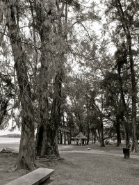
Discover Putatan in Malaysia
Putatan in the region of Sabah with its 78,340 habitants is a town located in Malaysia - some 1,008 mi or ( 1623 km ) East of Kuala Lumpur , the country's capital .
Local time in Putatan is now 11:55 AM (Monday) . The local timezone is named " Asia/Kuching " with a UTC offset of 8 hours. Depending on your flexibility, these larger cities might be interesting for you: Simunul, Narra, Bongao, Kampong Pangalat Besar, and Kampung Kipovo. When in this area, you might want to check out Simunul . We found some clip posted online . Scroll down to see the most favourite one or select the video collection in the navigation. Are you looking for some initial hints on what might be interesting in Putatan ? We have collected some references on our attractions page.
Videos
Half Yard of Ale Beer Chug in 7secs only!
Grand Final Beer Drinking Contest @ DJunction, KK on 28 Oct 2008 - Winner finish in 7 secs!!! ..
Fastest Beer Drinking using Half Yard of Ale Glass
Beer Drinking Contest @ DJunction, KK on 07 Oct 2008 - Winner finish in 10 secs ..
Takeoff At Kota Kinabalu
Taking off on runway 02 of Kota Kinabalu International Airport (BKI) on board Malaysia Airlines flight MH 637 to Kuching (KCH). The flight flies above Tanjung Aru, Sutera Harbour, above the city cente ..
Good Place For Plane Watching, Kota Kinabalu
A interesting spot for those who loves planes in Kota Kinabalu, Sabah. This road runs parallel to runway 20 of the airport. Here you really can see planes taking off. This road is seldom passed by veh ..
Videos provided by Youtube are under the copyright of their owners.
Interesting facts about this location
Petagas War Memorial
The Petagas War Memorial is a testament to those who lost their lives defending Sabah against the Japanese Occupation Army during World War II, particularly those of the ill fated Kinabalu Guerrillas. This article attempts to trace the story behind the creation of the Memorial, the people associated with it and the relevance to the post war history of Sabah.
Located at 5.92 116.06 (Lat./Long.); Less than 1 km away
Kota Kinabalu International Airport
Kota Kinabalu International Airport (KKIA) serves the city of Kota Kinabalu, the state capital of Sabah, Malaysia. It is located about 8 km southwest of the city centre. It is the second busiest airport in Malaysia after Kuala Lumpur International Airport, handling 5.8 million passengers in 2011. It is the main gateway into the state of Sabah and into Borneo.
Located at 5.94 116.05 (Lat./Long.); Less than 2 km away
Donggongon
Donggongon is a town in the West Coast Division of Sabah, Malaysia. The town is located within the district of Penampang, but today it can be considered as part of Greater Kota Kinabalu and is located about 15 kilometres from Kota Kinabalu. As of 2007, it has a population of 78,086. Donggongon is a very important town for the district of Penampang. The Penampang District Police Headquarters, Penampang District Library, and the Penampang Sports Complex, are located in Donggongon.
Located at 5.92 116.08 (Lat./Long.); Less than 3 km away
Double Six Monument
The Double Six Monument is a memorial located at Sembulan area in Grace Garden housing complex in Kota Kinabalu, Sabah, Malaysia which marks the site of the June 6, 1976 fatal plane crash known as the Double Six Tragedy bearing the first Chief Minister of Sabah, Tun Fuad Stephens, as well as six other State ministers.
Located at 5.96 116.06 (Lat./Long.); Less than 4 km away
Sabah Museum
The Sabah Museum is the state Museum of Sabah, Malaysia. It is sited on 17 ha of land at Bukit Istana Lama in Kota Kinabalu, the state capital. The complex contains not only the museum proper, but also an ethnobotanic garden, a zoo and a heritage village. The main building also houses the Sabah Art Gallery. Other galleries cover Islamic Civilization, Archaeology and History, Natural History, and Ceramics and Brassware.
Located at 5.96 116.07 (Lat./Long.); Less than 4 km away
Pictures
Historical Weather
Related Locations
Information of geographic nature is based on public data provided by geonames.org, CIA world facts book, Unesco, DBpedia and wikipedia. Weather is based on NOAA GFS.


