-
You are here:
- Homepage »
- Malta »
- Hal Tarxien » Tarxien

Tarxien Destination Guide
Touring Tarxien in Malta
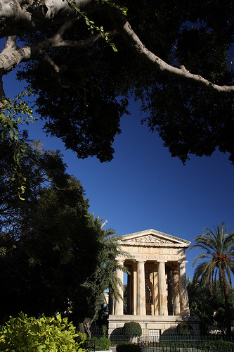
Tarxien in the region of Ħal Tarxien with its 7,761 citizens is a city located in Malta close to Valletta , the country's capital city .
Time in Tarxien is now 11:18 AM (Friday) . The local timezone is named " Europe/Malta " with a UTC offset of 1 hours. Depending on your travel resources, these more prominent places might be interesting for you: Tripoli, Sousse, Vittoria, Syracuse, and Scicli. Being here already, consider visiting Tripoli . We collected some hobby film on the internet . Scroll down to see the most favourite one or select the video collection in the navigation. Check out our recommendations for Tarxien ? We have collected some references on our attractions page.
Videos
Megalithic Malta 3 - Tarxien Temples
World Heritage Site. Complex of four prehistoric temples in Tarxien, Malta. ..
Senglea (Malta) - Maritime Festival - Marija Bambina 2010
The east side of the Grand Harbour in Malta is characterised by a number of promontories and creeks that, since time immemorial, have been found ideal for sheltering sea craft and ships. When the Knig ..
Passjoni mat-Toroq ta' Ħal-Tarxien 04 April 2009
Beland Band (Żejtun) and King's Own Band (Valletta) were guest bands on 4 April 2009 during the event "Passjoni mat-Toroq ta' Ħal Tarxien", that included a pageant and other activities related to Good ..
Malta Air Show 2000 - Red Arrows Spectacular
A spectacular show by the Red Arrows aerobatics team during the Malta Air Show 2000 ..
Videos provided by Youtube are under the copyright of their owners.
Interesting facts about this location
Hypogeum of Ħal-Saflieni
The Hypogeum of Paola, Malta, literally meaning "underground" in Greek, is a subterranean structure dating to the Saflieni phase (3000-2500 BC) in Maltese prehistory. Thought to be originally a sanctuary, it became a necropolis in prehistoric times, as proven by the remains of more than 7,000 individuals that have been discovered during the course of the excavation. It is the only prehistoric underground temple in the world.
Located at 35.87 14.51 (Lat./Long.); Less than 1 km away
Cottonera Lines
The Cottonera Lines are a massive line of fortifications surrounding the Three Cities of Vittoriosa, Senglea, and Cospicua, in Malta. They are entirely built on four of the Bormla (Cospicua) hills. Grand Master Cottoner is still inked to Bormla with his surname's coat-of-arms now depicted in the emblem of the Bormla Local Council. They were designed by Italian engineer Antonio Maurizio Valperga in the 17th Century, and named after Grand Master Nicolau Cotoner.
Located at 35.88 14.52 (Lat./Long.); Less than 1 km away
Three Cities
The Three Cities is a collective description of the three fortified cities of Cospicua, Vittoriosa, and Senglea on the Island of Malta, which are enclosed by the massive line of fortification created by the Knights of St John, the Cottonera Lines. "Cottonera" is usually taken to include these Three Cities and Kalkara.
Located at 35.88 14.52 (Lat./Long.); Less than 1 km away
Hibernians Ground
Hibernians Stadium is a multi-use stadium in Paola, Malta. The Hibernians football ground was inaugurated on 9 November 1986. Hibernians became the first Maltese club to have their own football pitch. Nonetheless, Hibernians play most of their league matches in the National Stadium in Ta' Qali, since nearly all the Maltese Premier League matches are played there. The ground is used by Hibernians for their everyday training sessions.
Located at 35.88 14.51 (Lat./Long.); Less than 2 km away
Fort Saint Michael
Fort St Michael was a fortification on the island of Malta. A fort of that name was built by the Knights of Malta between 1551 and 1565 on the peninsula then known as Isla St Michael formed by Dockyard Creek and French Creek in Grand Harbour. This area is still known as L-Isla, but is now occupied by the fortified city of Senglea.
Located at 35.88 14.52 (Lat./Long.); Less than 2 km away
Pictures


Historical Weather
Related Locations
Information of geographic nature is based on public data provided by geonames.org, CIA world facts book, Unesco, DBpedia and wikipedia. Weather is based on NOAA GFS.