
Touring Zejtun in Malta
Zejtun in the region of Iż-Żejtun with its 11,549 citizens is located in Malta - some 3 mi or ( 5 km ) South of Valletta , the country's capital city .
Time in Zejtun is now 12:40 AM (Monday) . The local timezone is named " Europe/Malta " with a UTC offset of 1 hours. Depending on your budget, these more prominent places might be interesting for you: Tripoli, Sousse, Vittoria, Syracuse, and Scicli. Being here already, consider visiting Tripoli . We collected some hobby film on the internet . Scroll down to see the most favourite one or select the video collection in the navigation. Check out our recommendations for Zejtun ? We have collected some references on our attractions page.
Videos
Ellie White - Ziua Mea (Official Video)
Please DO NOT UPLOAD this video on your channel, in order to avoid copyright infringement. Play it from this channel only! Thank you for all your support!!! Join Ellie on: facebook.com twitter.com www ..
Malta recorrido por la isla y sus monumentos. MALTA
Interesante recorrido por esta Isla mediterránea, viaje verano 2004. ..
Banda Ta' L-Iljun Birzebbuga 2008
One of the last marches played in the afternoon before the ending festivities, Sunday 3rd August 2008 15th anniversary since the band club was forunded ..
Passjoni mat-Toroq ta' Ħal-Tarxien 04 April 2009
Beland Band (Żejtun) and King's Own Band (Valletta) were guest bands on 4 April 2009 during the event "Passjoni mat-Toroq ta' Ħal Tarxien", that included a pageant and other activities related to Good ..
Videos provided by Youtube are under the copyright of their owners.
Interesting facts about this location
Mamo Tower
Mamo Tower is a fortification on the island of Malta. It stands on rising ground above St Thomas Bay on the east shore of Malta. The Mamo family built the tower in 1657, as a fortified residence. In 1940 the British Military requisitioned the tower and used it as a Regional Headquarters. In support of this role, they constructed a pillbox on the roof. After World War II it was again a private house until 1987, when the poor condition of the building rendered it unsuitable for habitation.
Located at 35.85 14.56 (Lat./Long.); Less than 2 km away
Għar Dalam
Għar Dalam (pronounced ar dàlam in Maltese and meaning "Cave of Darkness") is a prehistorical cul de sac located on the outskirts of Birżebbuġa, Malta containing the bone remains of animals that were stranded and subsequently became extinct on Malta at the end of the Ice age. It has lent its name to the Għar Dalam phase in Maltese prehistory.
Located at 35.84 14.53 (Lat./Long.); Less than 2 km away
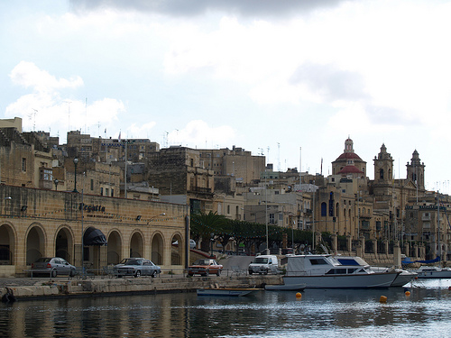
Three Cities
The Three Cities is a collective description of the three fortified cities of Cospicua, Vittoriosa, and Senglea on the Island of Malta, which are enclosed by the massive line of fortification created by the Knights of St John, the Cottonera Lines. "Cottonera" is usually taken to include these Three Cities and Kalkara.
Located at 35.88 14.52 (Lat./Long.); Less than 3 km away
Fort Tas-Silġ
Fort Tas-Silġ is a fortification on the island of Malta. It stands on high ground at the shoreward end of Delimara Point, above Il-Ħofra-z-Zgħira. It is a Polygonal fort and was built by the British. Its primary function was as a fire control point controlling the massed guns of Fort Delimara on the headland below. The fort is a classic example of the type. The gatehouse, and the shoreward ditch are in fair repair, but there has been considerable collapse of the inner face of the north ditch.
Located at 35.84 14.56 (Lat./Long.); Less than 3 km away
Hypogeum of Ħal-Saflieni
The Hypogeum of Paola, Malta, literally meaning "underground" in Greek, is a subterranean structure dating to the Saflieni phase (3000-2500 BC) in Maltese prehistory. Thought to be originally a sanctuary, it became a necropolis in prehistoric times, as proven by the remains of more than 7,000 individuals that have been discovered during the course of the excavation. It is the only prehistoric underground temple in the world.
Located at 35.87 14.51 (Lat./Long.); Less than 3 km away
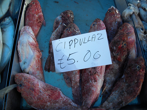
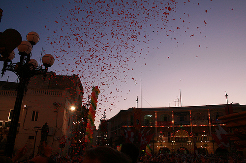
Pictures

Historical Weather
Related Locations

Information of geographic nature is based on public data provided by geonames.org, CIA world facts book, Unesco, DBpedia and wikipedia. Weather is based on NOAA GFS.