-
You are here:
- Homepage »
- Malta »
- Ix-Xghajra » Xghajra

Xghajra Destination Guide
Delve into Xghajra in Malta
Xghajra in the region of Ix-Xgħajra with its 837 residents is located in Malta close to Valletta , the country's capital .
Local time in Xghajra is now 05:23 AM (Tuesday) . The local timezone is named " Europe/Malta " with a UTC offset of 1 hours. Depending on your mobility, these larger destinations might be interesting for you: Tripoli, Sousse, Vittoria, Syracuse, and Scicli. While being here, you might want to check out Tripoli . We discovered some clip posted online . Scroll down to see the most favourite one or select the video collection in the navigation. Are you curious about the possible sightseeing spots and facts in Xghajra ? We have collected some references on our attractions page.
Videos
Sea Plane taking off next to HMS Illustrious - Malta
De Havilland DHC-3 Turbine Single Otter taking off from Malta's Grand Harbour on 28 February 2008 - shot from the watchtower at Senglea point with HMS Illustrious and the City of Valletta as a backdro ..
Oldest Ruins on Earth Ditchthecube's photos around Valetta, Malta (south american oldest ruins)
Preview of Ditchthecube's blog at TravelPod. Read the full blog here: www.travelpod.com This blog preview was made by TravelPod using the TripAdvisor™ TripWow slideshow creator. Learn more about these ..
Sea Plane Take-Off
Birds eye view of a sea plane taking off in Malta's Grand Harbour with the historic harbour fortifications of Vittoriosa (Birgu) and Senglea (L-Isla) in the background. ..
Fort Rinella Malta Reanactment of soldiers defending the fort/
Re-enactment 19th Century British soldiers firing rifles at Fort Rinella Malta ..
Videos provided by Youtube are under the copyright of their owners.
Interesting facts about this location
Fort St. Rocco
Fort St Rocco, also known as Fort St Roca on some maps, is a fortification on the island of Malta. It stands east of the Rinella Battery and seaward of the village of Santu Rokku, and forms part of the complex of shore batteries defending the coast east of the mouth of Grand Harbour.
Located at 35.89 14.54 (Lat./Long.); Less than 1 km away
Fort Leonardo
Fort Leonardo also known as Fort St Leonardo, Fort San Leonardo and Fort San Anard is a fortification on the island of Malta. It stands between the villages of San Leonardo and Zonqor above the shore east of Grand Harbour. It was built between 1872 and 1878 by the British. Fort St Leonardo still exists, and is in reasonable repair, though a house has been built inside the ditch and the ditch in-filled to create an access. The seaward ditches are all in good repair.
Located at 35.88 14.56 (Lat./Long.); Less than 1 km away
Fort Rinella
Fort Rinella is a Victorian fortification on the island of Malta. It is also referred to as the Rinella Battery in some maps and publications.
Located at 35.89 14.53 (Lat./Long.); Less than 2 km away
Fort Ricasoli
Fort Ricasoli is a large fortification on the island of Malta. The fort was built by the Knights of Malta between 1670 and 1693.
Located at 35.90 14.53 (Lat./Long.); Less than 2 km away
Three Cities
The Three Cities is a collective description of the three fortified cities of Cospicua, Vittoriosa, and Senglea on the Island of Malta, which are enclosed by the massive line of fortification created by the Knights of St John, the Cottonera Lines. "Cottonera" is usually taken to include these Three Cities and Kalkara.
Located at 35.88 14.52 (Lat./Long.); Less than 3 km away
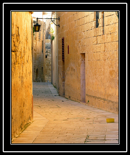
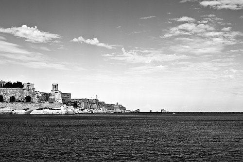
Pictures

Historical Weather
Related Locations
Information of geographic nature is based on public data provided by geonames.org, CIA world facts book, Unesco, DBpedia and wikipedia. Weather is based on NOAA GFS.