-
You are here:
- Homepage »
- Netherlands »
- South Holland » Maasdijk

Maasdijk Destination Guide
Explore Maasdijk in Netherlands
Maasdijk in the region of South Holland with its 5,000 inhabitants is a town in Netherlands - some 41 mi or ( 65 km ) South-West of Amsterdam , the country's capital city .
Current time in Maasdijk is now 12:11 AM (Saturday) . The local timezone is named " Europe/Amsterdam " with a UTC offset of 1 hours. Depending on the availability of means of transportation, these more prominent locations might be interesting for you: Westerlee, Vlaardingen, Utrecht, Spijkenisse, and S-Hertogenbosch. Since you are here already, make sure to check out Westerlee . We saw some video on the web . Scroll down to see the most favourite one or select the video collection in the navigation. Where to go and what to see in Maasdijk ? We have collected some references on our attractions page.
Videos
NETHERLANDS: storm surge barrier Maeslantkering
The "Maeslantkering" is a storm surge barrier located between Hoek van Holland and Maassluis, Netherlands. The movable barrier can close off the "Nieuwe Waterweg" waterway when water levels are threat ..
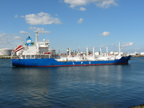
Craneship Balder leaving Rotterdam Europoort for Stavanger
Nikon D4 high iso test. Craneship Balder Leaving Rotterdam Europoort for Stavanger. Big tugs at front: Carlo Martello and President Hubert ..
Citadel Waterstudio
First project in the area of The New Water is the Citadel, the first floating apartment complex. With the design of the Citadel the level of ambition is set high. The building will consist of 60 luxur ..
Maassluis vanuit de lucht
Maassluis gefilmd vanuit de lucht! Tijdens een actie van Stichting on Wheels vanuit een kraan waarmee het mogelijk was boven Maassluis een kijkje te nemen. Eng: Airview of Maassluis, a city in The Net ..
Videos provided by Youtube are under the copyright of their owners.
Interesting facts about this location
Nieuwe Waterweg
The Nieuwe Waterweg ("New Waterway") is a ship canal in the Netherlands from het Scheur (a branch of the Rhine-Meuse-Scheldt delta) west of the town of Maassluis to the North Sea at Hook of Holland: the Maasmond, where the Nieuwe Waterweg connects to the Maasgeul. It is the artificial mouth of the river Rhine.
Located at 51.94 4.19 (Lat./Long.); Less than 2 km away
Maeslantkering
The Maeslantkering is a storm surge barrier on the imaginary dividing line between the Nieuwe Waterweg waterway located at Hoek van Holland and the river the Scheur located along the cities of Maassluis and Vlaardingen up to the confluence of the rivers Oude Maas and Nieuwe Maas, Netherlands, {{#invoke:Coordinates|coord}}{{#coordinates:51|57|18.98|N|4|09|49.63|E|region:NL_type:landmark |primary |name= }}, which automatically closes when needed.
Located at 51.96 4.16 (Lat./Long.); Less than 3 km away
De Lier
De Lier is a village in the Dutch province of South Holland. It is a part of the municipality of Westland, and lies about 5 km north of Maassluis. It also lies about 6 feet below sea level. The village of De Lier obtained its name from the name of an old river called De Lee. De Lier used to be a separate municipality. On 26 March 1963 it was granted their coat of arms and on 14 April 1965, it adopted their modern-day flag.
Located at 51.98 4.25 (Lat./Long.); Less than 4 km away
Maasland
Maasland is a town in the western Netherlands, in the province of South Holland. It lies in the municipality of Midden-Delfland and covers an area of 24.42 km² (of which 0.64 km² water). Maasland was a separate municipality until 2004, when it became part of Midden-Delfland. The first signs of a community started back in 925 when the area became part of the county of Graaf Dirk II and a church was built.
Located at 51.93 4.27 (Lat./Long.); Less than 5 km away
Blaker, Netherlands
Blaker is a hamlet in the Dutch province of South Holland. It is located in the municipality of Westland, about 2 km northeast of the village of De Lier. The hamlet consists of a single road, stretching between the Leê canal and the Noord Lierweg road. The area in which the hamlet is located, the "Oude Lierpolder", used to be called "Blaker" as well.
Located at 51.98 4.27 (Lat./Long.); Less than 5 km away
Pictures

Historical Weather
Related Locations
Information of geographic nature is based on public data provided by geonames.org, CIA world facts book, Unesco, DBpedia and wikipedia. Weather is based on NOAA GFS.