-
You are here:
- Homepage »
- New Zealand »
- Manawatu-Wanganui » Waiouru

Waiouru Destination Guide
Delve into Waiouru in New Zealand
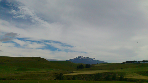
Waiouru in the region of Manawatu-Wanganui with its 1,347 residents is located in New Zealand - some 133 mi or ( 214 km ) North of Wellington , the country's capital .
Local time in Waiouru is now 05:01 PM (Friday) . The local timezone is named " Pacific/Auckland " with a UTC offset of 13 hours. Depending on your mobility, these larger destinations might be interesting for you: Wellington, Tangiwai, Richmond, Raketapauma, and Palmerston North. While being here, you might want to check out Wellington . We discovered some clip posted online . Scroll down to see the most favourite one or select the video collection in the navigation. Are you curious about the possible sightseeing spots and facts in Waiouru ? We have collected some references on our attractions page.
Videos
Srila Gurudeva NZ 2008
"Greed for Krishna" On a morning walk in New Zealand, Srila Bhaktivedanta Narayana Maharaja explains that by hearing high class vaisnavas, one attains greed for serving Sri Krishna. Complete set of DV ..
High Country Train Crossing
At New Zealand's highest railway station Waiouru, the Auckland to Wellington Tourist train "The Overlander" crosses a special excursion railcar which has come from Auckland down here and is about to r ..
Prince of Wales Geyser
Prince of Wales Geyser Rotorua New Zealand ..
03 - Crazy Biker Tour - No Fuel.wmv
This can happen when in the sticks. ..
Videos provided by Youtube are under the copyright of their owners.
Interesting facts about this location
National Army Museum (New Zealand)
The National Army Museum (Maori - Te Mata Toa) is the museum of the New Zealand Army. It was formerly known as the Queen Elizabeth II Army Memorial Museum. It is situated 94 minutes south of Taupo on State Highway One, on the southern side of the small military town of Waiouru. The 1300 square metre museum is fortress-looking in design, complete with a bridge and moat. It took the 2nd Field Squadron of the Royal New Zealand Engineers (RNZE) 276 days to build, and was opened in October 1978.
Located at -39.48 175.67 (Lat./Long.); Less than 0 km away
Waiouru Military Camp
Waiouru Military Camp is a camp of the New Zealand Army in the central North Island near Waiouru. Waiouru is often referred to by soldiers as the home of the army as it houses the army marae and is the base where all New Zealand Army soldiers complete their initial basic training called All Arms Recruit Course (AARC).
Located at -39.47 175.68 (Lat./Long.); Less than 2 km away
Naval Communications Station Irirangi
The Naval Communications Station Irirangi of the Royal New Zealand Navy, which is 2 km north of Waiouru and near the Waiouru Army Camp, was established in WWII (1943) as the Waiouru W/T (Wireless Telegraph) Station. Its location, in the middle of the North Island, put it far away from the sea. The station was commissioned in July 1943, and at the peak period of the war had an establishment of about 150 personnel, of whom more than eighty were women.
Located at -39.53 175.66 (Lat./Long.); Less than 5 km away
Wahianoa River
The Wahianoa River is a river of the Manawatu-Wanganui Region of New Zealand's North Island. One of the headwaters of the Whangaehu River, it flows southeast from the southern slopes of Mount Ruapehu, gradually veering southwest before meeting the Whangaehu three kilometres northwest of Waiouru.
Located at -39.44 175.63 (Lat./Long.); Less than 6 km away
Tangiwai disaster
The Tangiwai disaster occurred at 22:21 on 24 December 1953 when the Whangaehu River bridge collapsed beneath a Wellington to Auckland express train at Tangiwai on New Zealand's North Island. With 11 carriages carrying 285 passengers and crew, 151 people died, making it the worst ever rail accident in New Zealand.
Located at -39.46 175.58 (Lat./Long.); Less than 8 km away
Pictures

Historical Weather
Related Locations
Information of geographic nature is based on public data provided by geonames.org, CIA world facts book, Unesco, DBpedia and wikipedia. Weather is based on NOAA GFS.