-
You are here:
- Homepage »
- New Zealand »
- Waikato » Turangi

Turangi Destination Guide
Explore Turangi in New Zealand
Turangi in the region of Waikato with its 3,401 inhabitants is a place in New Zealand - some 168 mi or ( 270 km ) North of Wellington , the country's capital city .
Time in Turangi is now 11:56 PM (Friday) . The local timezone is named " Pacific/Auckland " with a UTC offset of 13 hours. Depending on your budget, these more prominent locations might be interesting for you: Wellington, Tongariro, Palmerston North, Otukou, and New Plymouth. Since you are here already, consider visiting Wellington . We saw some hobby film on the internet . Scroll down to see the most favourite one or select the video collection in the navigation. Where to go and what to see in Turangi ? We have collected some references on our attractions page.
Videos
Flyfishing the Tongariro River, New Zealand
Big, scenic river in the North Island, with rainbow and brown trout. ..
Introduction to Turangi, Central New Zealand
white water rafting, fishing, skydiving. scenic flights, kayaking, hiking active volcanoes in the Tongariro Natioanl park, we have it all. Adventure central. ..
Extreme Backpackers Turangi
Conveniently located in Turangi the gateway to the Tongariro National Park, with daily transport to the Tongariro Crossing, Mt Ruapehu(ski fields). Relax in the warm lounge with sky TV or sunny courty ..
Hello from Turangi in New Zealand!
Fuer die naechsten 5 Wochen werd ich mir jetzt also Neuseeland anschauen. Bis jetzt FANTASTISCH!!! LG von der Mitte der Nordinsel! ..
Videos provided by Youtube are under the copyright of their owners.
Interesting facts about this location
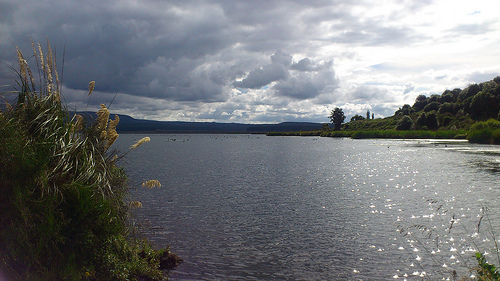
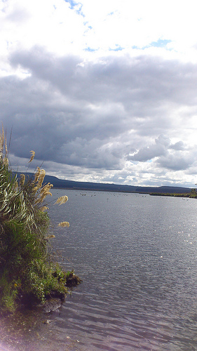
Tokaanu
Tokaanu is a small settlement close to Turangi at the southern end of Lake Taupo. The Tokaanu Thermal Pools and the easy access to Lake Taupo make it a popular lakeside holiday destination. A short walking track through the Tokaanu thermal area leads past steaming hot mineral pools and small mud pools dotted amongst the native bush. To the east of Tokaanu, another short walking track leads up the 490m high Manganamu, an extinct lava dome.
Located at -38.97 175.77 (Lat./Long.); Less than 4 km away
Waiotaka River
The Waiotaka River is a river of the Waikato Region of New Zealand's North Island. It flows northwest from its origins in the Kaimanawa Range to reach the southern shore of Lake Taupo five kilometres northeast of Turangi.
Located at -38.95 175.83 (Lat./Long.); Less than 5 km away
Tongariro River
The Tongariro River is a river in the North Island of New Zealand. The part of the Waikato River from the Waihohonu Stream, down to Lake Taupo, was formally named the Tongariro River in 1945. The river originates in the Central Plateau of the North Island where it is fed by numerous tributaries (such as the Whitikau, Poutu, and Mangamawhitiwhiti streams) that flow off the surrounding hill ranges and mountains such as Mount Ruapehu.
Located at -38.94 175.78 (Lat./Long.); Less than 6 km away
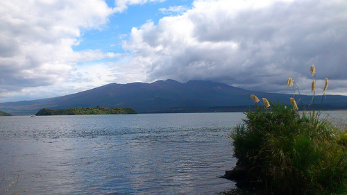
Pihanga
Mount Pihanga is a 1325m volcanic peak in the North Island Volcanic Plateau, located to the north of Mount Tongariro, between Tongariro and Lake Taupo. Lake Rotoaira lies immediately to the west of Pihanga, and the smaller Lake Rotopounamu is at the north-west foot of the mountain. Mt. Pihanga and Lake Rotopounamu are part of the 5,129ha Pihanga Scenic Reserve, which in 1975 was added to the Tongariro National Park.
Located at -39.04 175.77 (Lat./Long.); Less than 7 km away
Lake Rotopounamu
Lake Rotopounamu is a secluded lake in the Pihanga Scenic Reserve, in the Tongariro National Park in New Zealand's Central North Island. It lies at the northwest foot of Mt Pihanga, and was formed by a landslide around 10,000 years ago. The lake is fed by four streams, but has no surface outflow. It is believed to drain underground.
Located at -39.03 175.74 (Lat./Long.); Less than 7 km away
Pictures
Historical Weather
Related Locations
Information of geographic nature is based on public data provided by geonames.org, CIA world facts book, Unesco, DBpedia and wikipedia. Weather is based on NOAA GFS.