-
You are here:
- Homepage »
- United Kingdom »
- England » Downton

Downton Destination Guide
Touring Downton in United Kingdom
Downton in the region of England is a city located in United Kingdom - some 130 mi or ( 209 km ) North-West of London , the country's capital city .
Time in Downton is now 11:14 AM (Monday) . The local timezone is named " Europe/London " with a UTC offset of 0 hours. Depending on your travel resources, these more prominent places might be interesting for you: Yarpole, Wolverhampton, Orleton, Onibury, and Manchester. Being here already, consider visiting Yarpole . We collected some hobby film on the internet . Scroll down to see the most favourite one or select the video collection in the navigation. Check out our recommendations for Downton ? We have collected some references on our attractions page.
Videos
Birmingham City Centre ( Arrest ) The Ongoing Campaign For Fair Justice
Think about it this could be your family member this happens to ? The location was On Broad Stree Bham City Centre Near the Hyatt hotel . we the gf and i crossed a red light on a pedestrian crossing. ..
Tell me ma. Lunacy live (The Belle of Belfast City)
Lunacy playing live at The Unicorn Ludlow New years eve 2009 influenced by the doubliners ,gaelic storm and sham rock.The Pogues lots of beer lots of fun.Lots of lunatic foot tapping energy.Pete the f ..
Culmington Manor
A range of activities at Culmington Manor Outdoor Education Centre, Shropshire. ..
Fallout 3 The Settlers Guide
The first quest for the settlers mod to make your own village. sorry about when i take my time i was very very drunk when i did this. ..
Videos provided by Youtube are under the copyright of their owners.
Interesting facts about this location
Thomas Andrew Knight
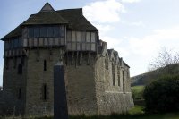
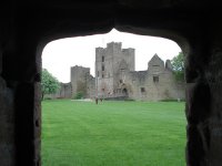
Thomas Andrew Knight, FRS (1759–1838) was a horticulturalist and botanist who lived at Downton Castle, Herefordshire. He was the brother of Richard Payne Knight.
Located at 52.37 -2.82 (Lat./Long.); Less than 1 km away
A4113 road
The A4113 road is a single-carriageway road that runs from Knighton in Powys to Bromfield in Shropshire, passing through north Herefordshire. From Knighton it heads east along the southern side of the Teme valley (heading downstream), crossing the Wales — England border into Herefordshire, then across the River Teme via Leintwardine Bridge (at 119 metres above sea level). The route then follows a Roman Road north through the Roman village of Leintwardine, leaving the Teme behind.
Located at 52.35 -2.89 (Lat./Long.); Less than 4 km away
Wigmore Abbey
Wigmore Abbey Parish is a parish with nine village churches in northwest Herefordshire. {{#invoke:Coordinates|coord}}{{#coordinates:52.335084|-2.864963|source:geograph. co. uk_region:GB_type:landmark|||||| |primary |name= }} Wigmore Abbey was an Augustinian abbey with a grange, from 1179 to 1530, situated about a mile (2 km) north of the village of Wigmore, Herefordshire, England. Only ruins of the abbey now remain.
Located at 52.34 -2.86 (Lat./Long.); Less than 4 km away
Adforton
Adforton is a small village and civil parish in north Herefordshire, England. It has a church which doubles as a community hall. It is situated on the A4110 main road approximately 22 miles north of Hereford.
Located at 52.33 -2.88 (Lat./Long.); Less than 5 km away
Walford, Letton and Newton
Walford, Letton and Newton is a civil parish in north Herefordshire, England, close to the border with Shropshire. Walford village lies just south of the River Teme about 2 km southwest of Leintwardine and 2 km northeast of Letton. The post town is Craven Arms and postcodes start with SY7. The A4113 Bromfield to Knighton road runs through the village. At the time of the Domesday Survey Walford was known as 'Waliforde', which may mean 'ford of the Welshmen'.
Located at 52.35 -2.90 (Lat./Long.); Less than 5 km away
Pictures
Related Locations
Information of geographic nature is based on public data provided by geonames.org, CIA world facts book, Unesco, DBpedia and wikipedia. Weather is based on NOAA GFS.


