-
You are here:
- Homepage »
- United Kingdom »
- England » Haydon Bridge

Haydon Bridge Destination Guide
Delve into Haydon Bridge in United Kingdom
Haydon Bridge in the region of England is located in United Kingdom - some 255 mi or ( 410 km ) North of London , the country's capital .
Local time in Haydon Bridge is now 11:23 AM (Tuesday) . The local timezone is named " Europe/London " with a UTC offset of 0 hours. Depending on your mobility, these larger destinations might be interesting for you: York, Whitfield, Wark, Warden, and Thorngrafton. While being here, you might want to check out York . We discovered some clip posted online . Scroll down to see the most favourite one or select the video collection in the navigation. Are you curious about the possible sightseeing spots and facts in Haydon Bridge ? We have collected some references on our attractions page.
Videos
Ploughing Competition at Park End, Simonburn.
Park End Farms hosted a ploughing contest organised by Charlie Halliday on behalf of the Northern Area Vintage Ploughing Association. Visit www.aquietlifeinthecountry.blogspot.com for a little light h ..
Walking on Hadrian's Wall (Once Brewed, England)
Walking on Hadrian's Wall, Once Brewed, England (August 2003). ..
Exposure: Why Do You Shoot? - Living Exposed Photography Project
Do you find yourself... looking? Exploring ancient Roman fortifications in the English countryside, this short film announces Exposure: Hawai'i, the first in a series of collaborative photographic pro ..
England Schottland 5: Hadrianswall und Fahrt nach Peebles
Hadrianswall und Fahrt nach Peebles ..
Videos provided by Youtube are under the copyright of their owners.
Interesting facts about this location
Elrington Halt railway station
Elrington Halt station is a closed stone built railway station situated on a single track branch railway line in Northumberland, England, that ran from Allendale through the Border Counties Junction to Hexham
Located at 54.96 -2.22 (Lat./Long.); Less than 2 km away
Langley-on-Tyne railway station
Langley-on-Tyne is a closed stone built railway station situated on a single track branch railway line in Northumberland, England, that ran from Allendale through the Border Counties Junction to Hexham.
Located at 54.95 -2.27 (Lat./Long.); Less than 4 km away
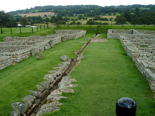
Stanegate
The Stanegate, or "stone road", was an important Roman road built in what is now northern England. It linked two forts that guarded important river crossings; Corstopitum in the east, situated on Dere Street, and Luguvalium in the west. The Stanegate ran through the natural gap formed by the valleys of the Tyne and Irthing.
Located at 55.01 -2.28 (Lat./Long.); Less than 4 km away
A69 road
The A69 is a major road in northern England, running east-west across the Pennines, through the counties of Tyne and Wear, Northumberland and Cumbria. Originally the road started in Blaydon, but since the creation of the A1 Western Bypass around Newcastle upon Tyne, it now starts at Denton Burn a suburb of Newcastle upon Tyne. The road runs up the Tyne valley, bypassing the village of Corbridge and the market town Hexham.
Located at 54.98 -2.33 (Lat./Long.); Less than 5 km away
Staward Halt railway station
Staward Halt is a closed stone built railway station situated on a single track branch railway line in Northumberland, England, that ran from Allendale through the Border Counties Junction to Hexham.
Located at 54.93 -2.30 (Lat./Long.); Less than 6 km away
Pictures
Related Locations
Information of geographic nature is based on public data provided by geonames.org, CIA world facts book, Unesco, DBpedia and wikipedia. Weather is based on NOAA GFS.