-
You are here:
- Homepage »
- United Kingdom »
- N Ireland » Bushmills

Bushmills Destination Guide
Explore Bushmills in United Kingdom
Bushmills in the region of N Ireland with its 1,309 inhabitants is a town in United Kingdom - some 367 mi or ( 590 km ) North-West of London , the country's capital city .
Current time in Bushmills is now 01:36 PM (Monday) . The local timezone is named " Europe/London " with a UTC offset of 0 hours. Depending on the availability of means of transportation, these more prominent locations might be interesting for you: Stranocum, Portrush, Moss-side, Derry, and Liverpool. Since you are here already, make sure to check out Stranocum . We encountered some video on the web . Scroll down to see the most favourite one or select the video collection in the navigation. Where to go and what to see in Bushmills ? We have collected some references on our attractions page.
Videos
Garvagh Clydesdale & Vintage Vehicle Club Ploughing Match 2011
Garvagh Clydesdale & Vintage Vehicle Club 13th Annual Vintage & Horse Ploughing Match at Plantation Road on Saturday 26th March 2011Please Visit BraidValley.com online Shop to see our wide range of DV ..
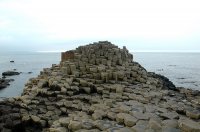
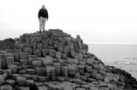
Giants Causeway
Recorded August 14, 2008 My visit to the beautiful Giant's Causeway along the Antrim Coast of Northern Ireland. Note: This replaces my earlier video which needed to be removed due to music issues. Fro ..
First Tee at Royal Portrush
Couldn't help but bust on my friend Ron starring as 'the clothes horse' on the first tee at Royal Portrush, Northern Ireland. It would be half as fun if it wasn't the truth. ..
minecraft survival ep 15 why you smash so easily boat!!!
Enjoy guys please watch in 720p or 1080p,thanks :) recorded with: FRAPS Texture pack: Doku craft light ..
Videos provided by Youtube are under the copyright of their owners.
Interesting facts about this location
Old Bushmills Distillery
The Old Bushmills Distillery is a distillery in Bushmills, County Antrim, Northern Ireland. It is owned and operated by Diageo plc, and is a popular tourist attraction, with around 120,000 visitors per year. According to the company, a distillery by this name was first recorded in 1743, although at the time it was "in the hands of smugglers" (in a quote attributed to Victorian whiskey journalist Alfred Barnard).
Located at 55.20 -6.52 (Lat./Long.); Less than 0 km away
Dundarave House
Dundarave is a country house in the village of Bushmills, County Antrim, Northern Ireland. It is the home to the Macnaghten family which is the chiefly family of Clan Macnaghten. Dundarave, which was built to replace Bushmills House, was designed by the eminent architect Sir Charles Lanyon was built in 1846, a contemporary of Castle Leslie. It occupies high ground over the village of Bushmills and the coastline of North Antim, near the port of Portballintrae.
Located at 55.21 -6.51 (Lat./Long.); Less than 1 km away
Giant's Causeway and Bushmills Railway
The Giant's Causeway and Bushmills Railway (GC&BR) is a 36 gauge narrow gauge heritage railway operating between the Giant's Causeway and Bushmills on the coast of County Antrim, Northern Ireland. The line is two miles (3.2 km) long.
Located at 55.21 -6.53 (Lat./Long.); Less than 1 km away
Causeway Coast and Glens District
Causeway Coast and Glens District is a proposed Northern Ireland local government district. The district will to be created by merging the Borough of Ballymoney, the Borough of Coleraine, the Borough of Limavady and District of Moyle. The new district will cover an area totalling 1796 km² spanning the coasts of Counties Antrim and Londonderry. The region would have a population of around 132,000. , and an electorate of 88,654.
Located at 55.20 -6.50 (Lat./Long.); Less than 1 km away
River Bush
The River Bush (from the Irish: an Bhuais) is an Ulster river in County Antrim, Northern Ireland. The river's source is in the Antrim Hills at 480m. From there the river flows northwest, with a bend at the town of Armoy. It then flows west, passing through Stranocum, and then bends north, passing through Bushmills before reaching the sea at Portballintrae on the North Antrim coast. It flows through a fertile valley devoted to grassland-based agriculture with limited arable cropping.
Located at 55.22 -6.53 (Lat./Long.); Less than 2 km away
Pictures
Related Locations
Information of geographic nature is based on public data provided by geonames.org, CIA world facts book, Unesco, DBpedia and wikipedia. Weather is based on NOAA GFS.

