-
You are here:
- Homepage »
- United Kingdom »
- Wales » Groeslon

Groeslon Destination Guide
Explore Groeslon in United Kingdom
Groeslon in the region of Wales is a town in United Kingdom - some 206 mi or ( 332 km ) North-West of London , the country's capital city .
Current time in Groeslon is now 12:12 PM (Saturday) . The local timezone is named " Europe/London " with a UTC offset of 0 hours. Depending on the availability of means of transportation, these more prominent locations might be interesting for you: Wallasey, Sheffield, Portmadoc, Oxford, and Menai Bridge. Since you are here already, make sure to check out Wallasey . We saw some video on the web . Scroll down to see the most favourite one or select the video collection in the navigation. Where to go and what to see in Groeslon ? We have collected some references on our attractions page.
Videos
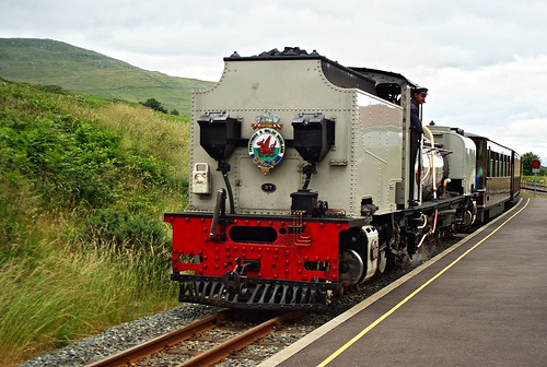
Welsh Highland Railway Super Power Weekend 2010
11th September 2010. Maximum Power with the Garratt! ..
mq Wales England Part 1 Motor holiday motorbike motorcycle motorrad bmw R1200RT
On www.lifeisjoy.nl you can watch all our movies and read our travelstories. Until 2010 20x round the world, mostly on motorcycles. England Wales visiting Ipswich, Birmingham, Northampton, Betws-y-coe ..
WHR(C) Tuesday Gang works train passing Tryfan Junction
WHR Tuesday Gang Express pulled by Caernarfon Castle passing Tryfan Junction. The 2 DZ wagons are loaded with approx 300 interlocking concrete blocks intended for ballast retaining walls. ..
K1 - alias Edward scissor hands
K1 enters Dinas from Caernarvon with the service train. Look at the front of the engine to see why some call it " Edward scissor hands" ..
Videos provided by Youtube are under the copyright of their owners.
Interesting facts about this location
Groeslon railway station
Groeslon was a railway station located in Groeslon, Gwynedd. This station was closed in December 1964.
Located at 53.08 -4.28 (Lat./Long.); Less than 0 km away
Groeslon
Groeslon is a small village in the community of Llandwrog in the Welsh traditional county of Caernarfonshire. Groeslon is administered by Gwynedd Council. Nearby villages are Penygroes, Carmel and Dinas. The village lies approximately five miles south of Caernarfon. It has one primary school in the centre of the village and no secondary schools. Most secondary school age pupils go to Ysgol Dyffryn Nantlle in Penygroes.
Located at 53.07 -4.28 (Lat./Long.); Less than 1 km away
Llanwnda railway station
Llanwnda was a railway station located in Llanwnda, Gwynedd. This station was closed in December 1964. Following the building of the Penygroes By-pass in 1999/2000, the site of the station has been obliterated by a roundabout where the A487 and A499 meet.
Located at 53.09 -4.28 (Lat./Long.); Less than 2 km away
A499 road
The A499 road is the major road of the Llŷn peninsula in North Wales. Its northern terminus is a roundabout with the A487 trunk road between Llanwnda and Llandwrog . It then runs south-westerly along the northern coast of the peninsula, through Clynnog Fawr then turns inland crossing the peninsula to meet the southern coast at Pwllheli, it then follows that southern coast to terminate at Abersoch . The total length is 23.4 miles.
Located at 53.09 -4.28 (Lat./Long.); Less than 2 km away
Dinas, Gwynedd
Dinas is a large hamlet near Bontnewydd, Caernarfon, in Gwynedd, north-west Wales. It is in the ancient parish and modern community of Llanwnda and is served by the parish church of St. Gwyndaf in Llanwnda village, which is about a quarter of a mile to the south. The hamlet developed with the opening of the turnpike Toll roads from Caernarfon first to Pwllheli in 1805, then to Porthmadog in 1810.
Located at 53.10 -4.27 (Lat./Long.); Less than 3 km away
Pictures

Related Locations
Information of geographic nature is based on public data provided by geonames.org, CIA world facts book, Unesco, DBpedia and wikipedia. Weather is based on NOAA GFS.