-
You are here:
- Homepage »
- United States »
- California » Dixon Lane-Meadow Creek

Dixon Lane-Meadow Creek Destination Guide
Explore Dixon Lane-Meadow Creek in United States
Dixon Lane-Meadow Creek in the region of California with its 2,645 inhabitants is a town in United States - some 2,232 mi or ( 3591 km ) West of Washington , the country's capital city .
Current time in Dixon Lane-Meadow Creek is now 04:34 PM (Sunday) . The local timezone is named " America/Los Angeles " with a UTC offset of -7 hours. Depending on the availability of means of transportation, these more prominent locations might be interesting for you: Bishop, Bridgeport, Brockmans Corner, Genes Mobile Home Park, and Glenwood Mobile Estates. Since you are here already, make sure to check out Bishop . We encountered some video on the web . Scroll down to see the most favourite one or select the video collection in the navigation. Where to go and what to see in Dixon Lane-Meadow Creek ? We have collected some references on our attractions page.
Videos
Bishop Sk8 park
©ShutterMeShort Photography My first attempt at a skate video! All shot on my new Nikon D90 and with local kids! Filmed at the Bishop city skatepark. Skaters and biker: -Willie Willis -Colten Scott -K ..
Mule Days 2009 Havervwilltravl's photos around Bishop, United States (mule days bishop ca 2009)
Preview of Havervwilltravl's blog at TravelPod. Read the full blog here: www.travelpod.com This blog preview was made by TravelPod using the TripAdvisor™ TripWow slideshow creator. Learn more about th ..
Bishop TownHouse Motel
VERY friendly people who run this motel. You don't need to go to one of the major chains to get a good room at a good price. Enjoy this place for what it is. And its a gem of a place. 625 N Main St Bi ..
Comfort Inn Bishop Ca Travellin Man (760) 873-4284
Comfort Inn 805 N Main St Bishop, Ca 760-973-4284 ..
Videos provided by Youtube are under the copyright of their owners.
Interesting facts about this location
Dixon Lane-Meadow Creek, California
Dixon Lane-Meadow Creek is a census-designated place (CDP) in Inyo County, California, United States. The population was 2,645 at the 2010 census, down from 2,702 at the 2000 census.
Located at 37.38 -118.42 (Lat./Long.); Less than 0 km away
Bishop Paiute Tribe
The Bishop Paiute Tribe, formerly known as the Paiute-Shoshone Indians of the Bishop Community of the Bishop Colony is a federally recognized tribe of Northern Paiute and Timbisha Indians of the Owens Valley, in Inyo County of eastern California.
Located at 37.37 -118.42 (Lat./Long.); Less than 2 km away
Bishop Union High School
Bishop Union High School (BUHS) is a secondary school in Bishop, California. It is part of the Bishop Unified School District. The school is located at 301 North Fowler Street. The current principal is Allen Van Velzen and the vice principal is David Kalk. The superintendent is Barry Simpson. There are currently thirty-nine teachers at the high school. Classes at the school run from 7:59 am to 2:15 pm on Mondays and 7:59 am to 3:00 pm Tuesdays through Fridays.
Located at 37.36 -118.40 (Lat./Long.); Less than 3 km away
Edwards Air Force Base
Edwards Air Force Base (AFB) is a United States Air Force base located approximately 22 miles northeast of Lancaster, California. It is the home of the Air Force Flight Test Center and is the Air Force Materiel Command center of excellence for conducting and supporting research and developmental flight test and evaluation of aerospace systems from concept to combat. It operates the U.S.
Located at 37.37 -118.36 (Lat./Long.); Less than 5 km away
Eastern Sierra Regional Airport
Eastern Sierra Regional Airport is a public-use airport located two nautical miles (4 km) east of the central business district of Bishop, in Inyo County, California, United States. It is owned by the City of Los Angeles, Department of Public Works and operated by Inyo County.
Located at 37.37 -118.36 (Lat./Long.); Less than 5 km away
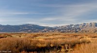
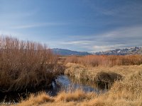
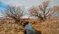
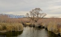
Pictures
Related Locations
Information of geographic nature is based on public data provided by geonames.org, CIA world facts book, Unesco, DBpedia and wikipedia. Weather is based on NOAA GFS.

