-
You are here:
- Homepage »
- United States »
- California » Fulton

Fulton Destination Guide
Explore Fulton in United States
Fulton in the region of California with its 541 inhabitants is a town in United States - some 2,440 mi or ( 3926 km ) West of Washington , the country's capital city .
Current time in Fulton is now 02:29 AM (Thursday) . The local timezone is named " America/Los Angeles " with a UTC offset of -7 hours. Depending on the availability of means of transportation, these more prominent locations might be interesting for you: Bakersfield, Fairfield, Forestville, Fresno, and Graton. Since you are here already, make sure to check out Bakersfield . We encountered some video on the web . Scroll down to see the most favourite one or select the video collection in the navigation. Where to go and what to see in Fulton ? We have collected some references on our attractions page.
Videos
F-18 Hornet - Wings Over Wine Country
Wings Over Wine Country - F-18 Hornet ..
FREAK OUT the Movie
FREAK OUT ! Tails the life of Carl Franzoni . Carl Franzoni was one of the LA freaks in the early sixties. Frank Zappa wrote 'Hungry Freaks, Daddy' for him.Carl Franzoni took part in some of the early ..
PDA 2012 Fall Welcome, President's Address & Keynote.mp4
President's Address: Dr. Frank Chong Our keynote speaker, Dr. Robert Johnstone, is a senior research fellow for the Research and Planning (RP) group who served as an evaluator for the Aspen Institute ..
Summer Vacation at Windsor, CA, July 19-24, 2009 (Part 1)
Watch in HQ. At last, we were on summer vacation at Windsor, CA. In this video, it shows the journey to our resort at Windsor. We went on San Rafael Bridge, and crossed many new places, since we've ne ..
Videos provided by Youtube are under the copyright of their owners.
Interesting facts about this location
Kendall-Jackson
Kendall-Jackson Vineyard Estates is a vineyard and winery, under the Kendall-Jackson brand, located in Santa Rosa, California in the Sonoma Valley wine country. As of 2010 Kendall-Jackson was the highest-selling brand of "super-premium" wine (an industry term referring to wine retailing for more than $15 per bottle) in the United States.
Located at 38.48 -122.77 (Lat./Long.); Less than 1 km away
Mark West, California
Mark West is an unincorporated community immediately north of Santa Rosa, California in Sonoma County, California, USA. Mark West is located along Mark West Springs Road adjacent to U.S. Highway 101. The community of Mark West is named for Scottish American pioneer William Marcus West. After the San Francisco and North Pacific Railroad was extended to Cloverdale in 1870's, its trains stopped in Mark West. The community is in ZIP code 95492 and area code 707.
Located at 38.51 -122.78 (Lat./Long.); Less than 2 km away
Cardinal Newman High School (Santa Rosa, California)
Cardinal Newman High School is an American Catholic high school located in Santa Rosa, California. Founded on April 24, 1964, and named for Cardinal John Henry Newman, it was one of the top 50 Catholic high schools in the nation for 2005, according to the Acton Institute's Catholic High School Honor Roll. On Tuesday, November 9, 2010, Cardinal Newman's sister school, Ursuline High School, announced that it would close at the end of the academic year.
Located at 38.49 -122.74 (Lat./Long.); Less than 3 km away
Piner High School
Piner High School (PHS) is a Public high school in Santa Rosa, California, United States. It is part of the Santa Rosa High School District, which is itself part of Santa Rosa City Schools.
Located at 38.46 -122.77 (Lat./Long.); Less than 4 km away
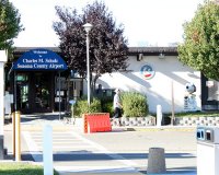
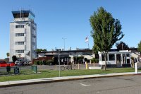
Charles M. Schulz–Sonoma County Airport
Charles M. Schulz–Sonoma County Airport is a county-owned public-use airport located 6 nautical miles (11 km) northwest of downtown Santa Rosa, a city in Sonoma County, California, United States. It serves the county and surrounding areas of northern California's Wine Country. The airport is named after Charles M. Schulz, the famed cartoonist of the Peanuts comic strip, who lived and worked in Santa Rosa for more than 30 years.
Located at 38.51 -122.81 (Lat./Long.); Less than 4 km away
Pictures
Related Locations
Information of geographic nature is based on public data provided by geonames.org, CIA world facts book, Unesco, DBpedia and wikipedia. Weather is based on NOAA GFS.

