-
You are here:
- Homepage »
- United States »
- California » Isleton

Isleton Destination Guide
Explore Isleton in United States
Isleton in the region of California with its 804 inhabitants is a place in United States - some 2,385 mi or ( 3839 km ) West of Washington , the country's capital city .
Time in Isleton is now 06:35 PM (Saturday) . The local timezone is named " America/Los Angeles " with a UTC offset of -7 hours. Depending on your budget, these more prominent locations might be interesting for you: Bakersfield, Bethel Island, Bridgehead, Daisie, and Eagle Tree. Since you are here already, consider visiting Bakersfield . We saw some hobby film on the internet . Scroll down to see the most favourite one or select the video collection in the navigation. Where to go and what to see in Isleton ? We have collected some references on our attractions page.
Videos
SS Minnow-Snug Harbour Ca.
Old boats in the back sloughs of Sacramento. No sign of Gilligan though ..
Jetski Bass Fishing in HD
First trip out on my newly modified Waverunner. I turned it into a bass boat! Full HD! Extended Edition ..
Rio Vista from the Sacramento River
Rio Vista is a city located in the eastern end of Solano County, California, on the Sacramento River, in the Sacramento River Delta region. The population was 4571 at the 2000 Census. Rio Vista was vi ..
Delta Thunder Boat Racing Isleton October 3, 2009
www.eastcontracostacountyrealestate.com Delta Thunder Boat Racing in Isleton California on October 3, 2009 ..
Videos provided by Youtube are under the copyright of their owners.
Interesting facts about this location
Isleton, California
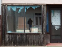
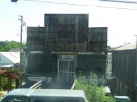
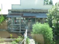
Isleton is a city in Sacramento County, California, United States. The population was 804 at the 2010 census, down from 828 at the 2000 census. It is located on Andrus Island amid the slough wetlands of the Sacramento-San Joaquin River Delta, on the eastern edge of the Rio Vista Gas Field. The city has many preserved 19th-century era storefronts along its main street, some of which show distinct Chinese influences.
Located at 38.16 -121.61 (Lat./Long.); Less than 0 km away
Andrus Island
Andrus Island is an island in the Sacramento-San Joaquin River Delta in Sacramento County, California, twenty kilometres northeast of Antioch. The 3,000-hectare island is bounded on the north, and northwest by the Sacramento River, on the west, Georgiana Slough, on the southeast, Mokelumne River, and San Joaquin River, on the southwest Jackson Slough, and Seven Mile Slough.
Located at 38.16 -121.60 (Lat./Long.); Less than 1 km away
Rio Vista Gas Field
The Rio Vista Gas Field is a large natural gas field in the Sacramento – San Joaquin River Delta in northern California. Discovered in 1936, and in continuous operation since, it has produced over 3.6 trillion cubic feet of gas in its lifetime, and retains an estimated reserve of approximately 330 billion cubic feet . In 2008 alone, the most recent year for which data was available, it produced 18 billion cubic feet of gas.
Located at 38.14 -121.68 (Lat./Long.); Less than 6 km away
USCGC Fir (WLM-212)
The United States Coast Guard Cutter Fir (WAGL/WLM 212) was the last lighthouse tender built specifically for the United States Lighthouse Service to resupply lighthouses and lightships, and to service buoys. Fir was built by the Moore Drydock Company in Oakland, California in 1939. On 22 March 1939, the U.S. Lighthouse Tender Fir was launched. She was steam driven with twin screws, 175 feet in length, had a beam of 32 feet, drew 11 feet 3 inches of water, and displaced 885 tons.
Located at 38.15 -121.68 (Lat./Long.); Less than 6 km away
Twitchell Island
Twitchell Island is an island in the Sacramento-San Joaquin River Delta in Sacramento County, California, 35 kilometres southwest of Sacramento. At 2 metres below sea level, the 1,200 ha is bounded on the north by Seven Mile Slough, on the east and south by the San Joaquin River, and on the west by Three Mile Slough. The island is entirely within the Rio Vista Gas Field, although well pads and associated infrastructure make up only a small part of its land use.
Located at 38.11 -121.65 (Lat./Long.); Less than 7 km away
Pictures
Related Locations
Information of geographic nature is based on public data provided by geonames.org, CIA world facts book, Unesco, DBpedia and wikipedia. Weather is based on NOAA GFS.


