-
You are here:
- Homepage »
- United States »
- California » Three Rivers

Three Rivers Destination Guide
Explore Three Rivers in United States
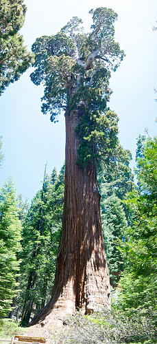
Three Rivers in the region of California with its 2,182 inhabitants is a town in United States - some 2,276 mi or ( 3663 km ) West of Washington , the country's capital city .
Current time in Three Rivers is now 02:07 AM (Wednesday) . The local timezone is named " America/Los Angeles " with a UTC offset of -7 hours. Depending on the availability of means of transportation, these more prominent locations might be interesting for you: Bakersfield, Citro, Ellis Place, Fresno, and Goodale. Since you are here already, make sure to check out Bakersfield . We saw some video on the web . Scroll down to see the most favourite one or select the video collection in the navigation. Where to go and what to see in Three Rivers ? We have collected some references on our attractions page.
Videos
Kaweah Falls: California Waterfall Retreat now a Vacation Rental
As seen in the NEW YORK TIMES, WALL STREET JOURNAL and SUNSET magazine. Now available as a vacation rental! Kaweah Falls is a modern rustic retreat-home tucked away at the base of the Sequoia National ..
Kernville and Sequoia National Park
A fantastic 3-day trip through Tehachapi, Bodfish and Kernville on up to Three Rivers and the Sequoia National Park. ..
Kaweah Falls: Sunday Morning
Sunday morning in Three Rivers, CA ..
The Giant Forest 78ers's photos around Three Rivers, United States (kings canyon national park)
Preview of 78ers's blog at TravelPod. Read the full blog here: www.travelpod.com This blog preview was made by TravelPod using the TripAdvisor™ TripWow slideshow creator. Learn more about these videos ..
Videos provided by Youtube are under the copyright of their owners.
Interesting facts about this location
Kaweah Colony
The Kaweah Colony was a utopian socialist community in central California founded in 1886. Located in the Sierra Nevada range, they lived near groves of giant sequoia trees. The colony officially disbanded in 1892. The establishment of Sequoia National Park in 1890 contributed to the colony's demise. Some of their descendants still reside in the area. Inspired by the writings of Laurence Gronlund, colony leaders attempted to apply the ideals of scientific socialism.
Located at 36.47 -118.92 (Lat./Long.); Less than 4 km away
Lake Kaweah
Lake Kaweah is a reservoir near Lemon Cove in Tulare County, California. The lake is formed by Terminus Dam on the Kaweah River. The river originates in the Sierra Nevada mountains and drains about 560 sq mi into Lake Kaweah. From Lake Kaweah, the river passes near the city of Visalia as it flows west into the Tulare Lakebed. The lake has a capacity of 185,000 acre·ft . A project to raise the lake 21 ft was completed in 2004.
Located at 36.42 -119.00 (Lat./Long.); Less than 9 km away
California's 21st congressional district
California's 21st congressional district is a congressional district in the U.S. state of California that from 2003-2013 covered all of Tulare County and the eastern half of Fresno County. The district is currently represented by Republican David Valadao. The distinct is now centered in the Central Valley and includes Hanford and parts of Bakersfield.
Located at 36.50 -119.00 (Lat./Long.); Less than 11 km away
Lemon Cove, California
Lemon Cove is a census-designated place (CDP) in Tulare County, California, United States. The population was 308 at the 2010 census, up from 298 at the 2000 census.
Located at 36.38 -119.03 (Lat./Long.); Less than 13 km away
Moro Rock
Moro Rock is a granite dome rock formation in Sequoia National Park, California, USA. It is located in the center of the park, at the head of Moro Creek, between Giant Forest and Crescent Meadow. A stairway, designed by the National Park Service and built in the 1930s by the Civilian Conservation Corps, is cut into and poured onto the rock, so that visitors can hike to the top. The view from the rock encompasses much of the Park, including the Great Western Divide.
Located at 36.54 -118.76 (Lat./Long.); Less than 17 km away
Pictures
Related Locations
Information of geographic nature is based on public data provided by geonames.org, CIA world facts book, Unesco, DBpedia and wikipedia. Weather is based on NOAA GFS.