-
You are here:
- Homepage »
- Aruba »
- Aruba (general) » Sabaneta
Sabaneta Destination Guide
Explore Sabaneta in Aruba
Sabaneta in the region of Aruba (general) is a place in Aruba - some 8 mi or ( 13 km ) South-East of Oranjestad , the country's capital city .
Time in Sabaneta is now 11:18 AM (Monday) . The local timezone is named " America/Aruba " with a UTC offset of -4 hours. Depending on your budget, these more prominent locations might be interesting for you: Sint Anna, Roncado, Paradera, Oranjestad, and Noord. Since you are here already, consider visiting Sint Anna . We saw some hobby film on the internet . Scroll down to see the most favourite one or select the video collection in the navigation. Where to go and what to see in Sabaneta ? We have collected some references on our attractions page.
Videos
Driving to San Nicolas, Aruba
Driving to San Nicolas just past Aruba Airport ..
The Westin Aruba by AskAboutTravel.com
Recently transformed after an extensive revitalization, all guest rooms and suites have been upgraded, each featuring a private balcony, new furnishings, and premium amenities. This setting allows you ..
OUR ARUBA BEACH CHALET, SAVANETA
ARUBA BEACH CHALETS in SAVANETA, ARUBA is a beautiful, quiet condo away from the high rise hotels in the north of Aruba. You can't get closer to the beach and the ocean then our condo. The reef provid ..
Mountainbiking Aruba
Mountainbike in Aruba May 31, 2008. Zim trail to Santana Sabana Basora ..
Videos provided by Youtube are under the copyright of their owners.
Interesting facts about this location
Butucu
Butucu is a village on the island of Aruba, located towards the southernmost point of the island.
Located at 12.46 -69.91 (Lat./Long.); Less than 3 km away
Bringamosa
Bringamosa is a settlement on the island of Aruba, located towards the center of the island.
Located at 12.49 -69.96 (Lat./Long.); Less than 6 km away
Frenchman's Pass
Frenchman Pass is a narrow passage on the island of Aruba, between coral cliffs above the area known as Spanish Lagoon. From the pass one can see the remains of the Balashi Gold Mill. Legend has it that French pirates tried to invade Aruba in the early 17th century and were confronted by Indians in this narrow passage above Spanish Lagoon. After this encounter, the passage became known as “Franse Pas” or “Rooi Frances” in Papiamento, which translates to “Frenchman Pass” in English.
Located at 12.49 -69.97 (Lat./Long.); Less than 6 km away
Geography of Aruba
Aruba is a small Caribbean island about the size of Washington, D.C. , located 25 km north of the coast of Venezuela and 68 km northwest of Curaçao, the largest island of the Kingdom of the Netherlands. Aruba’s terrain is mostly flat with a few hills. There is little in the way of vegetation or outstanding physical features and no inland water.
Located at 12.50 -69.97 (Lat./Long.); Less than 7 km away
Baby Beach, Aruba
Baby Beach is a shallow, sheltered man-made lagoon located in Seroe Colorado, on the southeast end of the island of Aruba, and is frequented by locals and tourists alike. It is named Baby Beach as the water is so calm it is safe for very small children. The snorkeling at this location is great for children or travelers new to snorkeling. The beach is popular mostly due to the lack of waves and the shallow water. The Valero oil refinery is within sight of Baby Beach.
Located at 12.41 -69.88 (Lat./Long.); Less than 7 km away
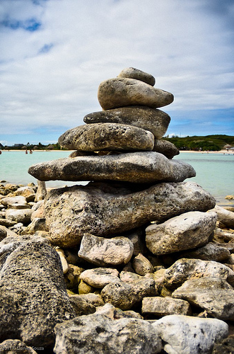
Pictures
Related Locations

Information of geographic nature is based on public data provided by geonames.org, CIA world facts book, Unesco, DBpedia and wikipedia. Weather is based on NOAA GFS.