-
You are here:
- Homepage »
- Aruba »
- Aruba (general) » Santa Cruz
Santa Cruz Destination Guide
Discover Santa Cruz in Aruba
Santa Cruz in the region of Aruba (general) is a place located in Aruba - some 4 mi or ( 7 km ) East of Oranjestad , the country's capital .
Local time in Santa Cruz is now 06:19 PM (Wednesday) . The local timezone is named " America/Aruba " with a UTC offset of -4 hours. Depending on your mobility, these larger cities might be interesting for you: Ceru Colorado, Paradera, Druif, Brasil, and Arasji. When in this area, you might want to check out Ceru Colorado . We discovered some clip posted online . Scroll down to see the most favourite one or select the video collection in the navigation. Are you looking for some initial hints on what might be interesting in Santa Cruz ? We have collected some references on our attractions page.
Videos
MISS KELLY'S ARUBA VACATION VLOG (Episode 2 - MissKellyTV)
Episode 2 - MissKellyTV SUBSCRIBE!!! FACEBOOK www.facebook.com EXCLUSIVE BLOG misskellyoj.blogspot.com MYSPACE http TWITTER www.twitter.com BLOGTV www.blogtv.com Introducing Aruba! Always gorgeous, al ..
Aruba - De Palm Tours
For more than 47 years De Palm Tours has lead the way to extraordinary Aruba adventures. Exploring the island on the ultimate overland adventure, sailing the waves on a sleek catamaran or moving to th ..
Aruba Marriott Resort & Stellaris Casino
A Marriott Associate takes a tour of the local area around the hotel. ..
Touching the Shadow: A new take on the Crucifixion
Visit Dimitri Halley's Facebook Page: www.facebook.com This video is a depiction of a dream of the narrator. In this dream the process of the re-taking of the shadow (projection) is represented as bei ..
Videos provided by Youtube are under the copyright of their owners.
Interesting facts about this location
Geography of Aruba
Aruba is a small Caribbean island about the size of Washington, D.C. , located 25 km north of the coast of Venezuela and 68 km northwest of Curaçao, the largest island of the Kingdom of the Netherlands. Aruba’s terrain is mostly flat with a few hills. There is little in the way of vegetation or outstanding physical features and no inland water.
Located at 12.50 -69.97 (Lat./Long.); Less than 0 km away
Bringamosa
Bringamosa is a settlement on the island of Aruba, located towards the center of the island.
Located at 12.49 -69.96 (Lat./Long.); Less than 1 km away
Cas Ariba
Cas Ariba is a village on the island of Aruba, located near the center of the island. Latitude 12.5000 Longitude -69.9500 Altitude 239 : 72 Lat (DMS) 12° 30' 0N Long (DMS) 69° 57' 0W Time zone (est) UTC-4
Located at 12.51 -69.97 (Lat./Long.); Less than 1 km away
Canashito
Canashito is a village on the island of Aruba, located towards near the western coast of the island.
Located at 12.50 -69.98 (Lat./Long.); Less than 2 km away
Frenchman's Pass
Frenchman Pass is a narrow passage on the island of Aruba, between coral cliffs above the area known as Spanish Lagoon. From the pass one can see the remains of the Balashi Gold Mill. Legend has it that French pirates tried to invade Aruba in the early 17th century and were confronted by Indians in this narrow passage above Spanish Lagoon. After this encounter, the passage became known as “Franse Pas” or “Rooi Frances” in Papiamento, which translates to “Frenchman Pass” in English.
Located at 12.49 -69.97 (Lat./Long.); Less than 2 km away
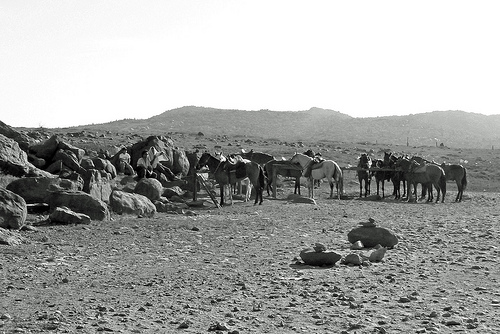
Pictures

Related Locations
 Conch Bar (Turks and Caicos Islands (general))
- Cockburn Harbour (Turks and Caicos Islands (general))
- Bambarra (Turks and Caicos Islands (general))
- Balfour Town (Turks and Caicos Islands (general))
- Sint Nicolaas (Aruba (general))
- Sint Anna (Aruba (general))
- Simeon Antonio (Aruba (general))
- Ceru Colorado (Aruba (general))
Information of geographic nature is based on public data provided by geonames.org, CIA world facts book, Unesco, DBpedia and wikipedia. Weather is based on NOAA GFS.