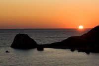
Discover Pissouri in Cyprus
Pissouri in the region of Limassol with its 1,078 habitants is a town located in Cyprus - some 51 mi or ( 82 km ) South-West of Nicosia , the country's capital .
Local time in Pissouri is now 11:16 PM (Monday) . The local timezone is named " Asia/Nicosia " with a UTC offset of 2 hours. Depending on your flexibility, these larger cities might be interesting for you: Trakhypedhoula, Prastio, Paphos, Nikoklia, and Nicosia. When in this area, you might want to check out Trakhypedhoula . We found some clip posted online . Scroll down to see the most favourite one or select the video collection in the navigation. Are you looking for some initial hints on what might be interesting in Pissouri ? We have collected some references on our attractions page.
Videos
Pissouri Cyprus Night 2010 - ExtraTV News 16/07/10
a short clip of a station in Cyprus talking about the Cyprus Night in Pissouri. Uploaded by Team Pissouri www.about-pissouri.com ..
my trip to Egypt at the RED Sea - Sharm El Sheikh
photos from my trip to exotic Sharm El Sheikh at the RED sea in Egypt. ..
Partyboy Pavlinia Cypern 2007 2
Boyz @ Pavlinia Agia Napa 2007 Partyboy from sweden at the pool side GVI Vangede ..
Pissouri Cyprus Night 2010-Andreas Philippou-Bouzouki
Cyprus Night 2010 At Pissouri Square Music By Haris Entertainment Disco Bouzouki - Andreas Speach - Ann-Marie ..
Videos provided by Youtube are under the copyright of their owners.
Interesting facts about this location
Pissouri
Pissouri is a village located in Limassol’s district, Cyprus (thirty kilometres westwards of Limassol’s centre), between Limassol and Paphos. Pissouri’s administrative area is the third biggest in Limassol District. The main settlement of Pissouri is situated about three kilometres away from the bay named Cape Aspro, and is built on the side of a green hill. The settlement, strangely, is placed in the middle of Pissouri’s territory.
Located at 34.67 32.70 (Lat./Long.); Less than 1 km away
Avdimou
Avdimou is a small village on the south coast of Cyprus, lying partly within the British Overseas Territory of Akrotiri and Dhekelia. Up to 1974 it was inhabited by a majority of Turkish-Cypriots, however, following the Turkish invasion the Turkish Cypriot residents were forcibly evacuated to the North. Greek Cypriot refugees from the North replaced the Turkish residents. Historically agriculture was the main source of income for the village (namely the local vine, olive and carob plantations).
Located at 34.70 32.77 (Lat./Long.); Less than 6 km away
Petra tou Romiou
Petra Tou Romiou (Rock of the Roman), or Aphrodite's Rock, is a sea stack in Pafos, Cyprus. Its status in mythology as the birthplace of Aphrodite makes it a popular tourist location. The sea in this region is generally rough, persuading tourists not to swim there. It is not permitted to climb the rock. A restaurant, a tourist pavilion and the Aphrodite Hills resort are nearby.
Located at 34.66 32.63 (Lat./Long.); Less than 7 km away
1222 Cyprus earthquake
The 1222 Cyprus earthquake occurred at about 06:15 UTC on 11 May. It had an estimated magnitude of 7.0–7.5 and triggered a tsunami that was recorded in Libya and Alexandria. The strongest shaking was felt in Nicosia, Limassol and Paphos.
Located at 34.70 32.60 (Lat./Long.); Less than 10 km away
Episkopi Bay
Episkopi Bay is a part of the Mediterranean Sea on the south-western shore of the island of Cyprus, located between the cities of Paphos and Limassol in the Limassol District. It is famous for its beach and fish restaurants. The Western Sovereign Base Area of Akrotiri and Dhekelia, a British Overseas Territory on the island of Cyprus, administered as a Sovereign Base Area, borders the bay.
Located at 34.63 32.83 (Lat./Long.); Less than 12 km away
Pictures
Historical Weather
Related Locations
Information of geographic nature is based on public data provided by geonames.org, CIA world facts book, Unesco, DBpedia and wikipedia. Weather is based on NOAA GFS.


