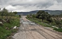
Touring Casarabonela in Spain
Casarabonela in the region of Andalusia with its 2,490 citizens is located in Spain - some 258 mi or ( 416 km ) South of Madrid , the country's capital city .
Time in Casarabonela is now 11:50 PM (Monday) . The local timezone is named " Europe/Madrid " with a UTC offset of 1 hours. Depending on your budget, these more prominent places might be interesting for you: Tolox, Seville, Pizarro, Monda, and Málaga. Being here already, consider visiting Tolox . We collected some hobby film on the internet . Scroll down to see the most favourite one or select the video collection in the navigation. Check out our recommendations for Casarabonela ? We have collected some references on our attractions page.
Videos
video de caidas y tonterias climbuilds
(La música la tuve que cambiar por el copyright) Vídeo de recopilatorio de muchas gilipolleces y caidas desde 2005 hasta la fecha. Espero que os guste :D yagolondio@hotmail.com ..
Caminito del Rey walkthrough. El Chorro, Spain. March 2012.
Hiking Caminito del Rey in March 2012. Teaser for this movie here: youtu.be Garmin Connect track: connect.garmin.com ..
Making of Little Big World
A small glimpse behind the scenes while shooting footage for a new episode of "Little Big World" in Spain. Shot in El Chorro on Camino del Rey and other locations with a GoPro Hero2 and Lumix GH2. Fol ..
Discovery Moto Tour Andalucia
El Chorro Gorge ..
Videos provided by Youtube are under the copyright of their owners.
Interesting facts about this location
Casarabonela
Casarabonela is a town and municipality in the province of Málaga, part of the autonomous community of Andalusia in southern Spain. The municipality is situated approximately 48 km from Malaga capital (bordering on the regions of Antequera and Ronda). It has a population of approximately 2,500 residents. The natives are called Moriscos.
Located at 36.78 -4.85 (Lat./Long.); Less than 1 km away
Carratraca
Carratraca is a town and municipality in the province of Málaga, part of the autonomous community of Andalusia in southern Spain. The municipality is situated approximately 56 km from Ronda and from the provincial capital of Málaga. It is located between the northeastern foothills of the Serrania de Ronda. It has a population of approximately 850 residents.
Located at 36.85 -4.82 (Lat./Long.); Less than 7 km away
El Burgo
El Burgo is a village and municipality in the province of Málaga, located in the autonomous community of Andalusia in southern Spain. It is located in the Parque Natural Sierra de las Nieves which was declared a Biosphere Reserve by UNESCO. In February they have a carnaval. Saint Augustin is celebrated at the end of August with traditional costumes, music, food and religious singing.
Located at 36.78 -4.93 (Lat./Long.); Less than 8 km away
Yunquera
Yunquera is a town and municipality in the province of Málaga, part of the autonomous community of Andalucía in southern Spain. It is located in the east of the province. The municipality is situated approximately 36 kilometres from Ronda and 63 from the provincial capital of Málaga. It has a population of approximately 3300 residents. The natives are called Yunqueranos.
Located at 36.73 -4.92 (Lat./Long.); Less than 9 km away
Tolox
Tolox is a town and municipality in the province of Málaga in the autonomous community of Andalusia in southern Spain. The municipality has a population of 2,317 (2006). It is situated in the centre of the Sierra de las Nieves Nature Park at the foot of the Sierra Blanca and the Sierra Parda. In addition to La Torrecilla peak (1,919 m. ), there are ancient woodlands of Spanish Fir and gall oak. The municipality covers 94 km, has a mean elevation of 285 m.
Located at 36.70 -4.90 (Lat./Long.); Less than 11 km away
Pictures
Related Locations
Information of geographic nature is based on public data provided by geonames.org, CIA world facts book, Unesco, DBpedia and wikipedia. Weather is based on NOAA GFS.


