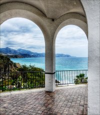
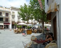
Touring Frigiliana in Spain
Frigiliana in the region of Andalusia with its 2,560 citizens is located in Spain - some 251 mi or ( 404 km ) South of Madrid , the country's capital city .
Time in Frigiliana is now 05:43 AM (Saturday) . The local timezone is named " Europe/Madrid " with a UTC offset of 1 hours. Depending on your budget, these more prominent places might be interesting for you: Sayalonga, Rio-Miel, El Morche, Marbella, and Málaga. Being here already, consider visiting Sayalonga . We collected some hobby film on the internet . Scroll down to see the most favourite one or select the video collection in the navigation. Check out our recommendations for Frigiliana ? We have collected some references on our attractions page.
Videos
Danza del vientre en Cádiz. Naima Bakkali. Danseuse Marocaine
Tab Wana Mali. Festival "Bailando Sueños" Frigiliana 2012 www.naimabakkali.es Egyptian style Bellydance. ..
Malaguena by E. Lecuona - Trio Los Panchos
Another version of Malaguena the classic composition for piano composed by Ernesto Lecuona from Cuba and arranged in dozens of version, here in the interpretation of famous Trio Los Panchos from Mexic ..
www.frigiliana-apartment.com view
Panoramic country, sea and mountain views from the apartment, www.frigiliana-apartment.com ..
RIO CHILLAR 2010
10.agosto.2010,rio de nerja..para pasar un dia especial ..
Videos provided by Youtube are under the copyright of their owners.
Interesting facts about this location
Caves of Nerja
The Caves of Nerja (Spanish: Cueva de Nerja) are a series of caverns close to the town of Nerja in the Province of Málaga, Spain. Stretching for almost 5 kilometres, the caverns are one of Spain's major tourist attractions. Concerts are regularly held in one of the chambers, which forms a natural amphitheatre. The caves were re-discovered in modern times on 12 January 1959 by five friends, who entered through a narrow sinkhole known as "La Mina".
Located at 36.76 -3.85 (Lat./Long.); Less than 5 km away
Árchez
Árchez is a small village in the province of Málaga, in southern Spain. The village is situated approximately 21 kilometres from Vélez Málaga. It has a population of approximately 408 residents, which are known as Archeros. Archez is located on the foothills of the Sierra Almijara on the scenic Mudejar Route which winds its way through some of the most picturesque white-washed villages of the Axarquia. Archez has a beautiful valley setting. The River Turvilla runs through the village.
Located at 36.83 -3.98 (Lat./Long.); Less than 9 km away
Cómpeta
Cómpeta is a town and municipality in the comarca of Axarquía, and province of Málaga, part of the autonomous community of Andalusia in southern Spain. The municipality is situated approximately 18 kilometres from the coast, and 52 kilometres from Málaga, the provincial capital. It is situated at 638 metres above sea level in the foothills of La Maroma (the highest peak of the Sierra Tejeda). The population is spread over the southern slopes of the Sierra de Almijara.
Located at 36.83 -3.98 (Lat./Long.); Less than 9 km away
Canillas de Albaida
Canillas de Albaida is a town and municipality in the province of Málaga, part of the autonomous community of Andalusia in southern Spain. It has a population of approximately 800 residents. The natives are called Canilleros. The village is one of several typical Andalucian pueblos blancos which ring the edge of the national parks.
Located at 36.85 -3.98 (Lat./Long.); Less than 11 km away
Sayalonga
Sayalonga is a town and municipality in the province of Málaga, part of the autonomous community of Andalusia in southern Spain. It belongs to the comarca of La Axarquía. The municipality is situated approximately 38 kilometres from the capital of Málaga and 12 from Vélez Málaga. It has a population of approximately 1,300 residents. The natives are called Sayones.
Located at 36.80 -4.02 (Lat./Long.); Less than 11 km away
Pictures
Related Locations
Information of geographic nature is based on public data provided by geonames.org, CIA world facts book, Unesco, DBpedia and wikipedia. Weather is based on NOAA GFS.


