-
You are here:
- Homepage »
- Swaziland »
- Swaziland (general) » Big Bend

Big Bend Destination Guide
Delve into Big Bend in Swaziland
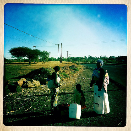
Big Bend in the region of Swaziland (general) with its 10,342 residents is located in Swaziland - some 60 mi or ( 97 km ) South-East of Mbabane , the country's capital .
Local time in Big Bend is now 11:30 PM (Tuesday) . The local timezone is named " Africa/Mbabane " with a UTC offset of 2 hours. Depending on your mobility, these larger destinations might be interesting for you: Siteki, Mbabane, Manzini, Lobamba, and Holobela. While being here, you might want to check out Siteki . We discovered some clip posted online . Scroll down to see the most favourite one or select the video collection in the navigation. Are you curious about the possible sightseeing spots and facts in Big Bend ? We have collected some references on our attractions page.
Videos
Four Lakes Goodrichodyssey's photos around Manguzi, South Africa (four lakes in south america)
Preview of Goodrichodyssey's blog at TravelPod. Read the full blog here: www.travelpod.com This blog preview was made by TravelPod using the TripAdvisor™ TripWow slideshow creator. Learn more about th ..
Videos provided by Youtube are under the copyright of their owners.
Interesting facts about this location
Big Bend, Swaziland
Big Bend is a town in eastern Swaziland, lying on the Lusutfu River. Its main industry is based on sugar plantations. {{#invoke:Coordinates|coord}}{{#coordinates:26|49|S|31|56|E|region:SZ_type:city|| |primary |name= }}
Located at -26.82 31.93 (Lat./Long.); Less than 0 km away
Nkilongo
Nkilongo is an inkhundla of Swaziland, located in the Lubombo District. Its population as of the 2007 census was 15,907.
Located at -26.82 31.88 (Lat./Long.); Less than 6 km away
Lubuli
Lubuli is a town in southeastern Swaziland. It is located close to the South African border just to the northwest of the town of Nsoko on the road between there and Maloma.
Located at -27.02 31.90 (Lat./Long.); Less than 22 km away
Phuzumoya
Phuzumoya is a town in eastern Swaziland on the MR8 road, located close to the junction of the Usutu and Lusutfu Rivers, some ten kilometres east of Siphofaneni. In the form Phuzamoya, the town's train station is shown in the film Wah-Wah.
Located at -26.68 31.75 (Lat./Long.); Less than 24 km away
Border Cave
Border Cave is a rock shelter on the western scarp of the Lebombo Mountains in KwaZulu-Natal near the border between South Africa and Swaziland. Border Cave has a remarkably continuous stratigraphic record of occupation spanning about 200 ka. Anatomically modern Homo sapiens skeletons together with stone tools and chipping debris were recovered. Dating by Carbon-14, amino acid racemisation and electron spin resonance places the oldest sedimentary ash at some 200 kiloannum.
Located at -27.03 31.99 (Lat./Long.); Less than 24 km away
Pictures
Historical Weather
Related Locations

Information of geographic nature is based on public data provided by geonames.org, CIA world facts book, Unesco, DBpedia and wikipedia. Weather is based on NOAA GFS.