-
You are here:
- Homepage »
- Ukraine »
- Avtonomna Respublika Krym » Oreanda

Oreanda Destination Guide
Discover Oreanda in Ukraine
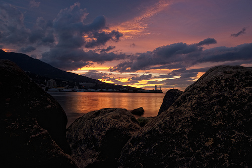
Oreanda in the region of Avtonomna Respublika Krym with its 858 habitants is a town located in Ukraine - some 447 mi or ( 720 km ) South-East of Kiev , the country's capital .
Local time in Oreanda is now 12:15 AM (Sunday) . The local timezone is named " Europe/Simferopol " with a UTC offset of 4 hours. Depending on your flexibility, these larger cities might be interesting for you: Zelenoye, Vinogradnoye, Tyuzler, Simferopol, and Simeiz. When in this area, you might want to check out Zelenoye . We found some clip posted online . Scroll down to see the most favourite one or select the video collection in the navigation. Are you looking for some initial hints on what might be interesting in Oreanda ? We have collected some references on our attractions page.
Videos
Крым 2011. Сколько стоит отдых в Крыму? Цены на отдых...
Цены на жильё в Крыму от 10 долларов с человека (это в частном секторе) гостиницы и санатории - не меньше 30 долларов в сутки, еще и поискать такие цены надо будет, но это юг, восток и запад Крыма деш ..
Ялта Июнь 2011
Климатопогодные условия курортов Южного берега Крыма уже весьма благоприятны для отдыха и лечения. Среднемесячная температура здесь уже выше 20 градусов. Абсолютная максимальная ее величина зафиксиров ..
Yalta, Crimea video #1 black sea summer sun
Home video, not professional :) Olympus Pen E-PL1, Helios 44m-6, m.Zuiko kit. Music: Titanium ..
Боткинская тропа
Боткинская тропа, а точнее её часть, проходит от "Поляны сказок" до водопада Учан-Су. Подробная информация на сайте www.gurzuf-yalta.com Прогулка на несколько часов доставит Вам только удовольствие. Д ..
Videos provided by Youtube are under the copyright of their owners.
Interesting facts about this location
Yalta Conference
The Yalta Conference, sometimes called the Crimea Conference and codenamed the Argonaut Conference, held February 4–11, 1945, was the World War II meeting of the heads of government of the United States, the United Kingdom, and the Soviet Union, represented by President Franklin D. Roosevelt, Prime Minister Winston Churchill, and General Secretary Joseph Stalin, respectively, for the purpose of discussing Europe's post-war reorganization.
Located at 44.47 34.14 (Lat./Long.); Less than 1 km away
Livadia Palace
Livadia Palace was a summer retreat of the last Russian tsar, Nicholas II, and his family in Livadiya, Crimea in southern Ukraine. The Yalta Conference was held there in 1945, when the palace housed the apartments of Franklin Delano Roosevelt and other members of the American delegation. Today the palace houses a museum, but it is sometimes used by the Ukrainian authorities for international summits.
Located at 44.47 34.14 (Lat./Long.); Less than 1 km away
Swallow's Nest
The Swallow's Nest (Ukrainian: Ластівчине гніздо, Lastivchyne hnizdo) is a decorative castle located between Yalta and Alupka on the Crimean peninsula in southern Ukraine. It was built between 1911 and 1912 in Gaspra, on top of 40-metre (130 ft) high Aurora Cliff, to a Neo-Gothic design by the Russian architect Leonid Sherwood. The castle overlooks the Cape of Ai-Todor of the Black Sea and is located near the remnants of the Roman castrum of Charax.
Located at 44.43 34.13 (Lat./Long.); Less than 3 km away
School of the Future (Yalta)
The School of the Future (Yalta) is a secondary school in Yalta.
Located at 44.49 34.15 (Lat./Long.); Less than 3 km away
Uchan-su (river)
Uchan-su, is a river that flows in the South Coast of Crimea. The name translates from the Crimean Tatar language for 'swift water' . The river runs into the Black Sea in the center city of Yalta. It begins at the foot of Ai-Petri, flows upstream the gorge and then at a distance of 2 km from the source forms the Uchan-su waterfall, located at an altitude of 390 meters and consists of several levels (the height of the waterfall is 98 meters).
Located at 44.48 34.17 (Lat./Long.); Less than 4 km away
Pictures
Historical Weather
Related Locations
Information of geographic nature is based on public data provided by geonames.org, CIA world facts book, Unesco, DBpedia and wikipedia. Weather is based on NOAA GFS.