-
You are here:
- Homepage »
- United Kingdom »
- England » Stokenchurch

Stokenchurch Destination Guide
Delve into Stokenchurch in United Kingdom
Stokenchurch in the region of England with its 4,037 residents is a city in United Kingdom - some 35 mi or ( 56 km ) West of London , the country's capital .
Current time in Stokenchurch is now 10:15 PM (Wednesday) . The local timezone is named " Europe/London " with a UTC offset of 0 hours. Depending on your travel modalities, these larger destinations might be interesting for you: Wolverhampton, Wargrave, Oxford, Northend, and Marlow. While being here, make sure to check out Wolverhampton . We encountered some video on the web . Scroll down to see the most favourite one or select the video collection in the navigation. Are you curious about the possible sightseeing spots and facts in Stokenchurch ? We have collected some references on our attractions page.
Videos
Minecraft Monday Show - Everything to know, every week!
Welcome to the Minecraft Monday show where I do all the research for ya! This way you have more time to play. Better yet this week I'm even hooking someone up with Mojang signed goodies! Cause Junkboy ..
Lego Indiana Jones - Power to the People Animation
Indy with his dad and friends go on a quest to find the mystical power source of the world. Along the way they run into trouble as the evil Doctor Inferno attempts to put a stop to their adventure by ..
Fawley Hill Railway June 2012
Sir William McAlpine's standard gauge Fawley Hill Railway, UK. 3rd June 2012. An acknowledged railway enthusiast, he returned to Hayes depot during the Beeching Axe to find that the company's Hudswell ..
Chinnor & Princes Risborough Railway
Clips from a steam journey film with a diesel journey bolted on (not shown here). Info from athought@f2s.com. The complete DVD Video can be obtained from the Station Shop at Chinnor. ..
Videos provided by Youtube are under the copyright of their owners.
Interesting facts about this location
Chiltern Hills
The Chiltern Hills form a chalk escarpment in South East England. They are known locally as "the Chilterns". A large portion of the hills was designated officially as an Area of Outstanding Natural Beauty in 1965.
Located at 51.67 -0.92 (Lat./Long.); Less than 2 km away
Stokenchurch BT Tower
Stokenchurch BT Tower is a telecommunication tower built of reinforced concrete at Stokenchurch, Buckinghamshire, England. It is one of the few British towers built of reinforced concrete. Located 242 metres above sea level, it dates from 1963 and is 97.5 metres tall. There are four platforms at the top that are used to attach microwave transmission drums and other antennas.
Located at 51.67 -0.92 (Lat./Long.); Less than 2 km away
Sir Charles Napier Inn
The Sir Charles Napier Inn (commonly known as the Sir Charles Napier or simply the Charles Napier) is a gastropub in Spriggs Alley about 1.5 miles south of Chinnor, Oxfordshire, England. It was built in the 18th century and is named after Sir Charles Napier. As of 2002 its proprietor for 35 years had been Julie Griffiths. Wine journalist Jancis Robinson has considered it to be one of several country pubs that has "outshone" city pubs.
Located at 51.68 -0.90 (Lat./Long.); Less than 2 km away
Stokenchurch Gap
The Stokenchurch Gap, also known as the Aston Rowant Cutting or Aston Hill cutting (from the nearby village of Aston Rowant), or locally "The Canyon" is a steep chalk cutting, constructed through the Chiltern Hills in Oxfordshire, England during the early 1970s for the M40 motorway. It is 1,200 metres long and a maximum of 47 metres deep, and is located approximately eight miles (13 km) from High Wycombe and close to the village of Stokenchurch.
Located at 51.66 -0.94 (Lat./Long.); Less than 3 km away
Wormsley Park
Wormsley Park is a 2,500 acre (10 km²) estate and 18th century country house between Stokenchurch and Watlington in the Chiltern Hills of Buckinghamshire, England. It is the former home of the philanthropist Sir Paul Getty who moved to Wormsley in 1986. He undertook a restoration which lasted until 1991, and lived there until his death in 2003. It is now the home of Mark Getty and his family and the site of the cricket field known as Sir Paul Getty's Ground.
Located at 51.64 -0.93 (Lat./Long.); Less than 3 km away
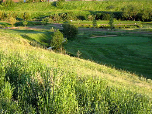
Pictures


Related Locations
Information of geographic nature is based on public data provided by geonames.org, CIA world facts book, Unesco, DBpedia and wikipedia. Weather is based on NOAA GFS.