-
You are here:
- Homepage »
- United Kingdom »
- Wales » Penllyn

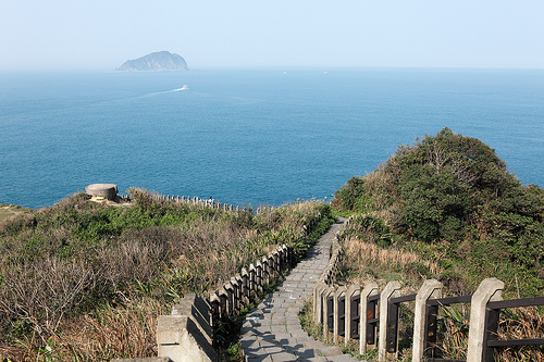
Penllyn Destination Guide
Explore Penllyn in United Kingdom
Penllyn in the region of Wales is a town in United Kingdom - some 144 mi or ( 232 km ) West of London , the country's capital city .
Current time in Penllyn is now 05:03 AM (Sunday) . The local timezone is named " Europe/London " with a UTC offset of 0 hours. Depending on the availability of means of transportation, these more prominent locations might be interesting for you: Swansea, Pontypridd, Pontycymer, Plymouth, and Pencoed. Since you are here already, make sure to check out Swansea . We encountered some video on the web . Scroll down to see the most favourite one or select the video collection in the navigation. Where to go and what to see in Penllyn ? We have collected some references on our attractions page.
Videos
My girlfriend dumped me for a gay man
TERRY'S GERT LUSH GUIDE TO BRISTOL DVD IS AVAILABLE AT WWW.TERRYTHEODDJOBMAN.COM My misses dumped me. I look a bit deshuveled. ..
A Blockland Zombie Game Played by RandomZace
my first video ..
Amazing Kart 360
Footage from Jonny Goddard and Micheal Horton at Llandow on Saturday 5th May 2012. Please share and spread. Thanks to Micheal for the footage. For more information on racing with Club 100 please visit ..
A Graveyard Visit 03/08
Scavenging for aircraft parts as part of a project to get me back in the air and on to the Falkland Islands. ..
Videos provided by Youtube are under the copyright of their owners.
Interesting facts about this location
Cowbridge Grammar School
Cowbridge Grammar School was one of the best-known schools in Wales until its closure in 1974. It was replaced by a comprehensive school. Founded in the 17th century by Sir John Stradling and refounded by Sir Leoline Jenkins, it had close links with Jesus College, Oxford. The school took both boarders and day boys. Famous old boys include actor Anthony Hopkins and poet Alun Lewis. The main school buildings were located in Church Street, Cowbridge.
Located at 51.46 -3.45 (Lat./Long.); Less than 2 km away
Llansannor
Llansannor is a small hamlet in the Vale of Glamorgan, Wales, United Kingdom. It has a population of roughly 200 people. It contains a parish church, a pub (the City Inn, now closed), a primary school and a village hall, which has recently been rebuilt thanks to the efforts of the parishioners.
Located at 51.49 -3.45 (Lat./Long.); Less than 2 km away
Cowbridge (Roman town)
Cowbridge was a small castra in Roman Wales within the Roman province of Britannia Superior. Today the contemporary settlement, Cowbridge, has a population of roughly 3,600. Its name in Latin is unknown, although it is the strongest candidate for Bovium (corrected from Bomio) of the Antonine Itinerary. Its remains have been discovered beneath Cowbridge in the Welsh county of Vale of Glamorgan, previously Glamorganshire.
Located at 51.46 -3.45 (Lat./Long.); Less than 3 km away
List of United Kingdom locations: X-Z
Y[edit] Location Locality Coordinates(links to map & photo sources) OS gridreference Y Bont-Faen (Cowbridge) The Vale Of Glamorgan {{#invoke:Coordinates|coord}}{{#coordinates:51.45|N|03.45|W|region:GB name= }} SS9974 Y Felinheli (Port Dinorwig) Gwynedd {{#invoke:Coordinates|coord}}{{#coordinates:53.17|N|04.21|W|region:GB name= }} SH5267 Y Fenni (Abergavenny) Monmouthshire {{#invoke:Coordinates|coord}}{{#coordinates:51.82|N|03.03|W|region:GB name= }} SO2914 Y Ferwig Ceredigion {{#invoke:Coordinates|coord}}{{#coordinates:52.10|N|04.65|W|region:GB name= }} SN1849 Y Fflint (Flint) Flintshire {{#invoke:Coordinates|coord}}{{#coordinates:53.23|N|03.14|W|region:GB name= }} SJ2472 Y Ffor Gwynedd {{#invoke:Coordinates|coord}}{{#coordinates:52.91|N|04.39|W|region:GB name= }} SH3938 y-Ffrith Denbighshire {{#invoke:Coordinates|coord}}{{#coordinates:53.33|N|03.44|W|region:GB name= }} SJ0483 Y Gelli Gandryll Powys {{#invoke:Coordinates|coord}}{{#coordinates:52.07|N|03.13|W|region:GB name= }} SO2242 Y Gribyn Powys {{#invoke:Coordinates|coord}}{{#coordinates:52.50|N|03.59|W|region:GB name= }} SN9291
Located at 51.45 -3.45 (Lat./Long.); Less than 3 km away
Ystradowen
Ystradowen is a small village twelve miles west of Cardiff, located in the Vale of Glamorgan in south Wales; its nearest town is Cowbridge which is about three miles to the south. The name Ystradowen means "Owen's Valley" in English. Local amenities include St Owain's parish church, The White Lion public house, Tudor Garage and Seven Oaks fisheries. Notable residents: Tom Jones had a home in the village until 1998.
Located at 51.48 -3.42 (Lat./Long.); Less than 4 km away
Pictures
Related Locations
Information of geographic nature is based on public data provided by geonames.org, CIA world facts book, Unesco, DBpedia and wikipedia. Weather is based on NOAA GFS.