-
You are here:
- Homepage »
- United States »
- California » Hawaiian Gardens

Hawaiian Gardens Destination Guide
Discover Hawaiian Gardens in United States
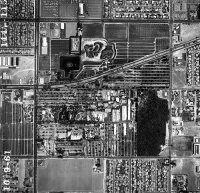
Hawaiian Gardens in the region of California with its 14,254 habitants is a place located in United States - some 2,290 mi or ( 3686 km ) West of Washington , the country's capital .
Local time in Hawaiian Gardens is now 12:45 PM (Thursday) . The local timezone is named " America/Los Angeles " with a UTC offset of -7 hours. Depending on your mobility, these larger cities might be interesting for you: Anaheim, Bakersfield, Bingham, Cerritos, and Downey. When in this area, you might want to check out Anaheim . We discovered some clip posted online . Scroll down to see the most favourite one or select the video collection in the navigation. Are you looking for some initial hints on what might be interesting in Hawaiian Gardens ? We have collected some references on our attractions page.
Videos
Three Trikes and a Rocket
GPS Track: connect.garmin.com Three trikes and a recumbent bike doing a 66 mile loop. We started at Carson Street in Long Beach on the San Gabriel River Trail and went upstream to the Whittier Narrows ..
SANTA STYLE a holiday parody of PSY's Gangnam Style by Los Alamitos High School Choir
Director, David Moellenkamp does it again! This awesome rendition of Psy's Gangnam style brought down the house at this year's Holiday Spectacular. ..
Raising city chickens and Joey - from chick to first year.m4v
We live in a suburban area, but only blocks from the city's very urban downtown. Our city has 1/2 million people. If you would like to see more of the photos of the edible landscape and how chickens a ..
Nature Hike, El Dorado Park, Long Beach, CA
Nature Hike, El Dorado Park, Long Beach, CA ..
Videos provided by Youtube are under the copyright of their owners.
Interesting facts about this location
Hawaiian Gardens, California
Hawaiian Gardens is a city in Los Angeles County, California, United States. It is the smallest city in the county (approximately 1.0 mi²) and was incorporated on April 9, 1964. The population was 14,254 at the 2010 census, down from 14,779 at the 2000 census. The town's unusual name originated in a 1920s refreshment stand that was decorated with palm fronds and bamboo. It was the then-rural area's main landmark for many years, and its name stuck as the small town grew up around it.
Located at 33.83 -118.07 (Lat./Long.); Less than 0 km away
Oxford Academy (California)
Oxford Academy is a college preparatory school in the suburbs of Cypress, California. The school is rigorous and highly competitive as students test to get in. According to U.S. News & World Report dated December 9, 2009, Oxford Academy is ranked fourth in national public high schools and fourteenth in the entire US. As of 2012 in the same ranking, Oxford Academy was ranked 7th in the nation among both public and private high schools.
Located at 33.82 -118.04 (Lat./Long.); Less than 3 km away
La Palma, California
La Palma is a city located in northern Orange County, California. The population was 15,408 at the 2000 census.
Located at 33.85 -118.04 (Lat./Long.); Less than 3 km away
Cypress, California
Cypress is a suburban city located in the northern region of Orange County within Southern California. Its population was 47,802 at the 2010 census.
Located at 33.82 -118.04 (Lat./Long.); Less than 3 km away
Cerritos High School
Cerritos High School, also called CHS, is a comprehensive, 4 year public high school in Cerritos, California, serving grades 9-12. It is part of the ABC Unified School District.
Located at 33.86 -118.06 (Lat./Long.); Less than 4 km away
Pictures
Related Locations
Information of geographic nature is based on public data provided by geonames.org, CIA world facts book, Unesco, DBpedia and wikipedia. Weather is based on NOAA GFS.


