-
You are here:
- Homepage »
- Denmark »
- South Denmark » Broager

Broager Destination Guide
Delve into Broager in Denmark
Broager in the region of South Denmark with its 3,376 residents is a city in Denmark - some 126 mi or ( 203 km ) South-West of Copenhagen , the country's capital .
Current time in Broager is now 02:42 AM (Thursday) . The local timezone is named " Europe/Copenhagen " with a UTC offset of 1 hours. Depending on your travel modalities, these larger destinations might be interesting for you: Vemmingbund, Sønderborg, Smol, Odense, and Molmark. While being here, make sure to check out Vemmingbund . We encountered some video on the web . Scroll down to see the most favourite one or select the video collection in the navigation. Are you curious about the possible sightseeing spots and facts in Broager ? We have collected some references on our attractions page.
Videos
Wedding Photography - Ditte and Mads - HD
The wedding of Ditte and Mads - 5th June 2010 Video and stills are shot with Canon 5DmkII with several Canon L-lenses. ..
Guitarsolo - Jeppe
Jeppe spiller guitarsolo i Come Together. Gråsten Musikfestival. Lørdag d.5. maj 2012 ..
ATR 42 in Denmark - ATR42 en Dinamarca
Landing of an ATR42-320 in Sønderborg, Denmark to be converted into cargo for Arkas. Aterrizaje de un ATR42-320 en Sønderborg, Dinamarca, para ser convertido a cargo para la aerolínea Arkas de Colombi ..
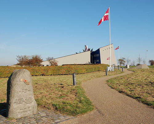
Düppeler Schanzen
Der Schauplatz der Entscheidungsschlacht im Deutsch-Dänischen Krieg am 18. April 1864 in der Nähe von Sønderborg ..
Videos provided by Youtube are under the copyright of their owners.
Interesting facts about this location
Broager
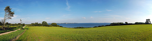
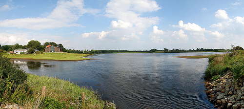
Broager is a town with a population of 3,376 (1 January 2011) in Sønderborg Municipality in Region of Southern Denmark in Denmark. It lies on the Broagerland peninsula, and is therefore surrounded by water on three sides, the waters of Flensborg Fjord leading into the Baltic Sea. The town of Broager lies in the middle of the peninsula by a major road, which leads to the Egernsund Bridge, which crosses over the Egern Strait to the Jutland mainland.
Located at 54.88 9.68 (Lat./Long.); Less than 0 km away
Dybbøl
Dybbøl is a small town, with a population of 2,457 (1 January 2011) in the southeastern corner of South Jutland, Denmark. It is located around 6 km west of Sønderborg. During the 1864 Second War of Schleswig, the Danish Army withdrew from the traditional fortified defence line of Dannevirke (after waters and marshes which supported its flanks froze hard in a hard winter) and marched for Dybbøl to find a better defendable position.
Located at 54.92 9.72 (Lat./Long.); Less than 4 km away
Battle of Dybbøl
The Battle of Dybbøl (Danish: Slaget ved Dybbøl; German: Erstürmung der Düppeler Schanzen) was the key battle of the Second Schleswig War and occurred on the morning of 18 April 1864 following a siege starting on 7 April. Denmark suffered a severe defeat against Prussia, which decided the war. Dybbøl was also a battlefield in the First Schleswig War.
Located at 54.91 9.76 (Lat./Long.); Less than 5 km away
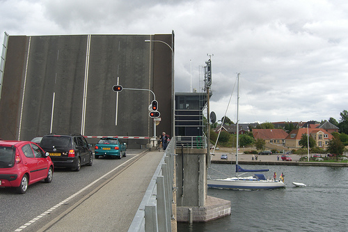
Egernsund Bridge
Egernsund Bridge is a Danish bascule bridge that runs between cities Alnor and Egernsund.
Located at 54.91 9.60 (Lat./Long.); Less than 6 km away
Alssund Bridge
The Alssund Bridge is a 662-metre-long girder bridge that carries Highway 8 across the Alssund north of Sønderborg, Denmark. Constructed between 1978 and 1981, it was officially opened on 19 October 1981 by Queen Ingrid.
Located at 54.92 9.77 (Lat./Long.); Less than 7 km away
Pictures


Historical Weather
Related Locations
Information of geographic nature is based on public data provided by geonames.org, CIA world facts book, Unesco, DBpedia and wikipedia. Weather is based on NOAA GFS.