-
You are here:
- Homepage »
- New Zealand »
- New Zealand (general) » Hunterville

Hunterville Destination Guide
Discover Hunterville in New Zealand
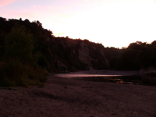
Hunterville in the region of New Zealand (general) with its 520 habitants is a town located in New Zealand - some 102 mi or ( 165 km ) North-East of Wellington , the country's capital .
Local time in Hunterville is now 01:45 PM (Friday) . The local timezone is named " Pacific/Auckland " with a UTC offset of 13 hours. Depending on your flexibility, these larger cities might be interesting for you: Wellington, Waituna West, Pukeroa, Palmerston North, and Pakihikura. When in this area, you might want to check out Wellington . We found some clip posted online . Scroll down to see the most favourite one or select the video collection in the navigation. Are you looking for some initial hints on what might be interesting in Hunterville ? We have collected some references on our attractions page.
Videos
Rangitikei valley
Taken on a stellar fine morning from Stormy point (betw Feilding and Taihape, just south of Vinegar Hill). Could see Egmont/Taranaki in distance, and Ruapehu clear as. ..
Highlights - Matthew & Maria
Matthew & Maria were married on 18 February 2012 at Orlando Country, Marton. ..
Three Days, 160 kms. One Cataraft, Rangitikei River NZ - Day 2
The second day of a three day trip that Brian Megaw undertook, rowing a cataraft from River Valley Lodge to the Tasman Sea on the Rangitikei River, New Zealand. The total journey was 160 kms. Follow t ..
Rangatiki Jetboat trip
..
Videos provided by Youtube are under the copyright of their owners.
Interesting facts about this location
Hunterville
Hunterville is a small community on State Highway 1, in the Rangitikei district of the North Island of New Zealand. It is located half way between Taupo and Wellington and has a population (2006 census) of 441. The township was founded in 1884 by a merchant named George Hunter. It straddles the state highway as well as the main trunk railway in the foothills forming the gateway to the Central Plateau.
Located at -39.93 175.57 (Lat./Long.); Less than 0 km away
Mangapapa River (Manawatu-Wanganui)
The Mangapapa River is a river of the Manawatu-Wanganui Region of New Zealand's North Island. The river rises near the remote settlement of Mangapapa, northwest of Mangaweka. It flows westward through heavily-eroded hilly farmland to meet the Turakina River. There is a 12 metre waterfall on the lower reaches of the river.
Located at -39.80 175.52 (Lat./Long.); Less than 15 km away
Rangitikei District
The Rangitikei District is a Territorial Authority located primarily in the Manawatu-Whanganui Region in the North Island of New Zealand, although a small part, the town of Ngamatea (13.63% by land area), of it lies in the Hawke's Bay Region. It is located in the southwest of the island, and follows the catchment area of the Rangitikei River.
Located at -39.79 175.64 (Lat./Long.); Less than 17 km away
Nga Tawa Diocesan School
Nga Tawa Diocesan School, also known as the Wellington Diocesan School for Girls, is an integrated, Anglican girls’ boarding school situated in the heart of the Rangitikei. It is found just outside the township of Marton in New Zealand.
Located at -40.07 175.40 (Lat./Long.); Less than 21 km away
Mangamahu
The Mangamahu District is a hill-country farming and forestry community in the middle reaches of the Whangaehu River valley, 50 km north-east of Wanganui, New Zealand. It is centered on the village of Mangamahu, which is situated on river flats where the Mangamahu stream flows into the Whangaehu river. Mangamahu has a primary school (25-30 children) which has been open since 1894 and a War Memorial hall built in 1952.
Located at -39.82 175.37 (Lat./Long.); Less than 21 km away
Pictures

Historical Weather
Related Locations
Information of geographic nature is based on public data provided by geonames.org, CIA world facts book, Unesco, DBpedia and wikipedia. Weather is based on NOAA GFS.