-
You are here:
- Homepage »
- United Kingdom »
- England » Shardlow

Shardlow Destination Guide
Explore Shardlow in United Kingdom
Shardlow in the region of England is a place in United Kingdom - some 108 mi or ( 173 km ) North-West of London , the country's capital city .
Time in Shardlow is now 12:01 AM (Saturday) . The local timezone is named " Europe/London " with a UTC offset of 0 hours. Depending on your budget, these more prominent locations might be interesting for you: Tonge, Shepshed, Sheffield, Sawley, and Risley. Since you are here already, consider visiting Tonge . We saw some hobby film on the internet . Scroll down to see the most favourite one or select the video collection in the navigation. Where to go and what to see in Shardlow ? We have collected some references on our attractions page.
Videos
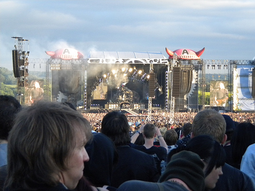
Download Festival 2012 Black Camp Mud!
Download Festival 2012 Black Camp Mud! This was actually filmed before it got reeeeeally bad! ..
JOURNEY - Don't Stop Believing - Download 2009
Journey playing at Download 2009 - Donington Park, UK - June 14th 2009 ..
Children of Bodom - Download Festival - JOURNEY!!!
LOVE IT!! Children of Bodom covering Journey - Dont Stop Believin @ Download Festival 2008 ..
Ryan Air- Take-off Nottingham East Midlands Airport
Take-off from East Midlands Airport. On 1st May 2009.It was an fun time, It only took a matter of 2 hours and we where landing in Milan, Orio Al Serio Airport. In a different time zone a different lan ..
Videos provided by Youtube are under the copyright of their owners.
Interesting facts about this location
Cavendish Bridge
Cavendish Bridge is the name of a bridge over the River Trent, and a hamlet, on the border between Leicestershire and Derbyshire. It once carried the main London-Manchester turnpike, though a modern dual carriageway has now been built to the south bypassing the location.
Located at 52.87 -1.34 (Lat./Long.); Less than 2 km away
Great Wilne
Great Wilne is a small village in Derbyshire, England on the border with Leicestershire. It is 7 miles south east of Derby. It is a village split from its church of St Chad's by the river. The church is at the very small hamlet of Church Wilne which can only be approached by a short walk via the bridge over the River Derwent, or by a fair car journey which necessitates travelling out of the county.
Located at 52.87 -1.33 (Lat./Long.); Less than 2 km away
South East Derbyshire Rural District
South East Derbyshire was a rural district in Derbyshire, England from 1894 to 1974. It covered an area to the south-east of Derby. It was formed as Shardlow rural district under the Local Government Act 1894, mainly from the Derbyshire part of the Shardlow rural sanitary district. It also administered the parishes of Ratcliffe on Soar and Kingston on Soar in Nottinghamshire - these became part of Leake Rural District in 1927. The district was renamed South East Derbyshire in 1959.
Located at 52.89 -1.38 (Lat./Long.); Less than 3 km away
Derwent Mouth
Derwent Mouth is a location on the River Trent, which at that point forms the border between the English counties of Derbyshire and Leicestershire. It is both the confluence of the River Derwent with the River Trent, and the point at which the Trent and Mersey Canal joins the natural River Trent. Derwent Mouth is situated some 1-mile east of Shardlow, and 2 miles west of Trent Lock, where the navigable River Soar and Erewash Canal join the River Trent.
Located at 52.87 -1.32 (Lat./Long.); Less than 3 km away
Hemington, Leicestershire
Hemington is a village in Leicestershire, England. In 1790, the nearby Harrington Bridge was built to create a crossing of the River Trent. The new bridge was a toll bridge and everyone except locals living in Hemington (or Sawley, Derbyshire were required to pay the toll. Gravel quarrying at Hemington during the 1990s led to the discovery of three sets of remains from successive medieval bridges across the Trent.
Located at 52.85 -1.33 (Lat./Long.); Less than 3 km away
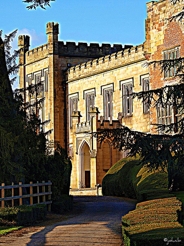
Pictures

Related Locations
Information of geographic nature is based on public data provided by geonames.org, CIA world facts book, Unesco, DBpedia and wikipedia. Weather is based on NOAA GFS.